ملف:Carte du canton de Saint-Christophe-en-Bazelle de 1790 à 2015.jpg

حجم هذه المعاينة: 590 × 599 بكسل. البعد الآخر: 1٬000 × 1٬016 بكسل.
الملف الأصلي (1٬000 × 1٬016 بكسل حجم الملف: 156 كيلوبايت، نوع MIME: image/jpeg)
وصف قصير
| ⧼wm-license-information-description⧽ |
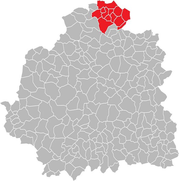
Français : Carte des communes de l'Indre (36) : Le canton de Saint-Christophe-en-Bazelle, de 1790 à 2015.
|
| ⧼wm-license-information-date⧽ | 2012 |
| ⧼wm-license-information-source⧽ | Wikimedia Commons (File:Blank Map of Indre Department, France, with Communes.svg) / ⧼Wm-license-own-work⧽ |
| ⧼wm-license-information-author⧽ | Floppy36 |
ترخيص
|
تاريخ الملف
اضغط على زمن/تاريخ لرؤية الملف كما بدا في هذا الزمن.
| زمن/تاريخ | صورة مصغرة | الأبعاد | مستخدم | تعليق | |
|---|---|---|---|---|---|
| حالي | ★ مراجعة معتمدة 03:56، 25 ديسمبر 2023 | | 1٬000 × 1٬016 (156 كيلوبايت) | Pastakhov (نقاش | مساهمات) | Upload https://upload.wikimedia.org/wikipedia/commons/f/f7/Carte_du_canton_de_Saint-Christophe-en-Bazelle_de_1790_%C3%A0_2015.jpg |
لا يمكنك استبدال هذا الملف.
وصلات
لا يوجد صفحات تصل لهذه الصورة.