ملف:Carte du Quercy.svg

حجم معاينة PNG لذلك الملف ذي الامتداد SVG: 597 × 599 بكسل. البعد الآخر: 2٬040 × 2٬048 بكسل.
الملف الأصلي (ملف SVG، أبعاده 1٬013 × 1٬017 بكسل، حجم الملف: 394 كيلوبايت)
وصف قصير
| ⧼wm-license-information-description⧽ |
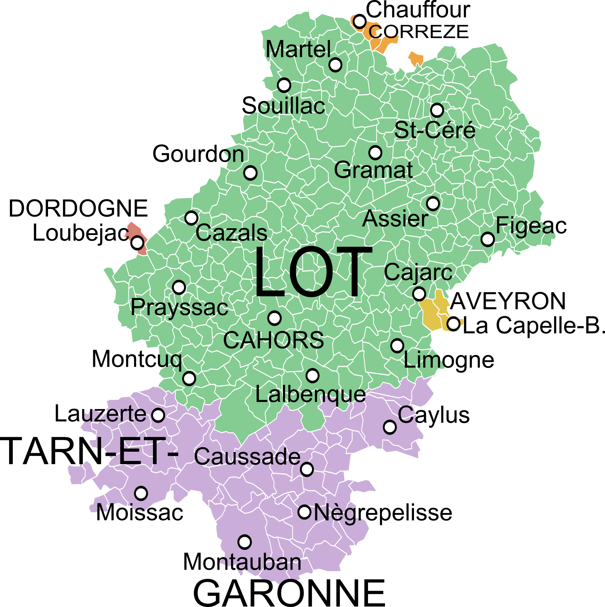
English: Map of the old province of Quercy, France, showing the communes according to the current administrative division. Français : Carte du pays du Quercy montrant les communes et les départements actuels.
|
| ⧼wm-license-information-date⧽ | 2014, {{time}} – invalid date format 36 (help) |
| ⧼wm-license-information-source⧽ | Partie orientale du gouvernement général de la Guienne où se trouvent le Quercy et le Rouergue, Robert de Vaugondy.
قالب:DerivativeVersions by Poulpy قالب:DerivativeVersions by Poulpy قالب:DerivativeVersions by Poulpy قالب:DerivativeVersions by Poulpy قالب:DerivativeVersions by Poulpy |
| ⧼wm-license-information-author⧽ | Oie blanche |
ترخيص
|
تاريخ الملف
اضغط على زمن/تاريخ لرؤية الملف كما بدا في هذا الزمن.
| زمن/تاريخ | صورة مصغرة | الأبعاد | مستخدم | تعليق | |
|---|---|---|---|---|---|
| حالي | ★ مراجعة معتمدة 20:02، 9 نوفمبر 2023 | | 1٬013 × 1٬017 (394 كيلوبايت) | Pastakhov (نقاش | مساهمات) | Upload https://upload.wikimedia.org/wikipedia/commons/9/94/Carte_du_Quercy.svg |
لا يمكنك استبدال هذا الملف.
وصلات
الصفحات التالية تحتوي على وصلة لهذه الصورة: