ملف:Calvert County Maryland Incorporated and Unincorporated areas Lusby Highlighted.svg

حجم معاينة PNG لذلك الملف ذي الامتداد SVG: 550 × 550 بكسل. البعد الآخر: 2٬048 × 2٬048 بكسل.
الملف الأصلي (ملف SVG، أبعاده 550 × 550 بكسل، حجم الملف: 71 كيلوبايت)
| ⧼wm-license-information-description⧽ |
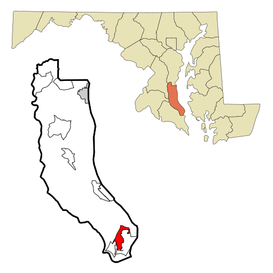
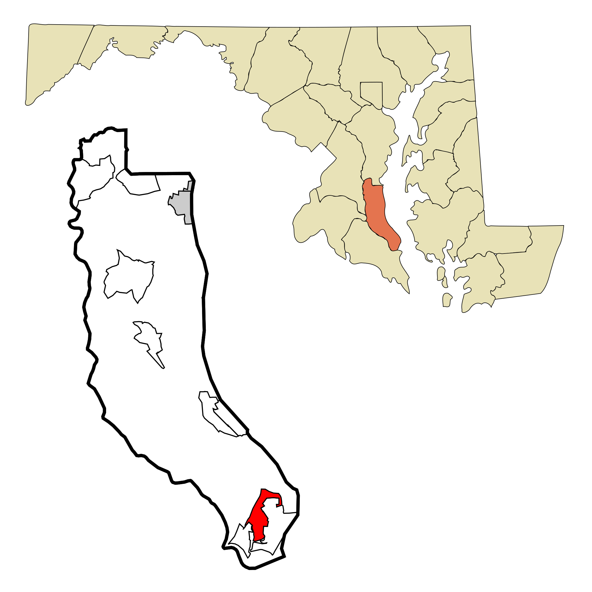
This map shows the incorporated and unincorporated areas in Calvert County, Maryland, highlighting Lusby in red. It was created with a custom script with US Census Bureau data and modified with Inkscape. |
| ⧼wm-license-information-date⧽ | 2007 |
| ⧼wm-license-information-source⧽ | My own work, based on public domain information. Based on similar map concepts by Ixnayonthetimmay |
| ⧼wm-license-information-author⧽ | Arkyan |
|

تاريخ الملف
اضغط على زمن/تاريخ لرؤية الملف كما بدا في هذا الزمن.
| زمن/تاريخ | صورة مصغرة | الأبعاد | مستخدم | تعليق | |
|---|---|---|---|---|---|
| حالي | ★ مراجعة معتمدة 00:40، 15 نوفمبر 2023 | | 550 × 550 (71 كيلوبايت) | Pastakhov (نقاش | مساهمات) | Upload https://upload.wikimedia.org/wikipedia/commons/c/c3/Calvert_County_Maryland_Incorporated_and_Unincorporated_areas_Lusby_Highlighted.svg |
لا يمكنك استبدال هذا الملف.
وصلات
لا يوجد صفحات تصل لهذه الصورة.