ملف:Cairnie Junction railway station (site), Aberdeenshire (geograph 5407700).jpg

حجم هذه المعاينة: 800 × 600 بكسل. البعد الآخر: 1٬600 × 1٬200 بكسل.
الملف الأصلي (1٬600 × 1٬200 بكسل حجم الملف: 592 كيلوبايت، نوع MIME: image/jpeg)
وصف قصير
| ⧼wm-license-information-description⧽ |
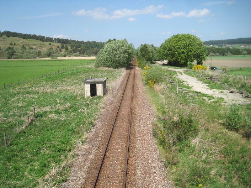
English: Cairnie Junction railway station (site), Aberdeenshire
Opened in 1897 by the Great North of Scotland Railway on its line from Aberdeen to Keith, this station was the junction for the Moray Coast line. The station closed in 1968. The line was later singled. View north towards Grange and Keith. The island platform was in the trees in the middle distance. No trace apparently remains. |
| ⧼wm-license-information-date⧽ | 2017 |
| ⧼wm-license-information-source⧽ | From geograph.org.uk |
| ⧼wm-license-information-author⧽ | Nigel Thompson |
| ⧼wm-license-information-permission⧽ (⧼wm-license-information-permission-reusing-text⧽) |
Creative Commons Attribution Share-alike license 2.0 |
| ⧼wm-license-cc-attribution⧽ (قالب:I18n/Credit line) |
Nigel Thompson / Cairnie Junction railway station (site), Aberdeenshire / |
57°31′55″N 2°49′40″W / 57.531937°N 2.827816°W قالب:Object location
,_Aberdeenshire_(geograph_5407700).jpg¶ms=57.531937_N_2.827816_W_source:geograph-osgb36(NJ50534939)_heading:337)
ترخيص
تاريخ الملف
اضغط على زمن/تاريخ لرؤية الملف كما بدا في هذا الزمن.
| زمن/تاريخ | صورة مصغرة | الأبعاد | مستخدم | تعليق | |
|---|---|---|---|---|---|
| حالي | ★ مراجعة معتمدة 11:59، 14 نوفمبر 2023 | | 1٬600 × 1٬200 (592 كيلوبايت) | Pastakhov (نقاش | مساهمات) | Upload https://upload.wikimedia.org/wikipedia/commons/2/24/Cairnie_Junction_railway_station_%28site%29%2C_Aberdeenshire_%28geograph_5407700%29.jpg |
لا يمكنك استبدال هذا الملف.
وصلات
لا يوجد صفحات تصل لهذه الصورة.
,_Aberdeenshire_(geograph_5407700).jpg&oldid=3523884)