ملف:COVID-19 outbreak Arizona county map.svg

حجم معاينة PNG لذلك الملف ذي الامتداد SVG: 517 × 599 بكسل. البعد الآخر: 1٬767 × 2٬048 بكسل.
الملف الأصلي (ملف SVG، أبعاده 5٬462 × 6٬331 بكسل، حجم الملف: 62 كيلوبايت)
وصف قصير
| ⧼wm-license-information-description⧽ |
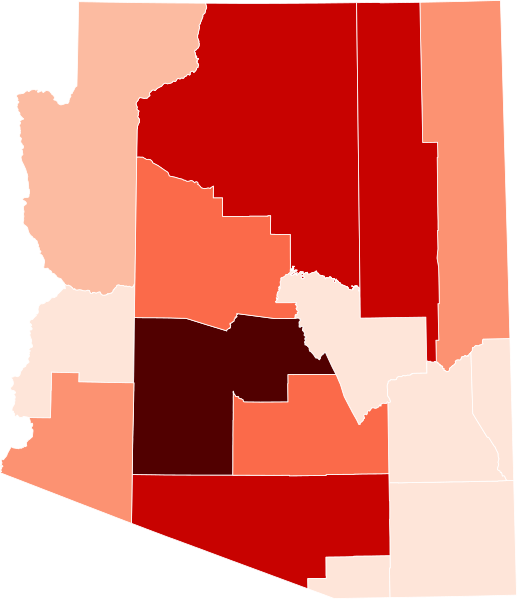
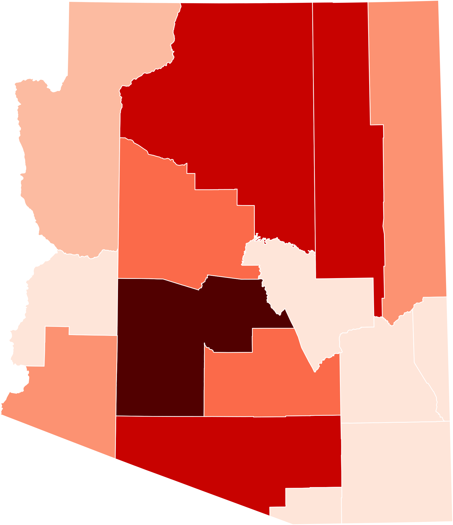
English: Map of confirmed COVID-19 cases in Arizona by county, data as of 02 April 2020.
Legend: 500+ cases
100-500 cases
25-100 cases
10-25 cases
5–10 cases
<5 cases |
| ⧼wm-license-information-date⧽ | 2020 |
| ⧼wm-license-information-source⧽ | ⧼Wm-license-own-work⧽ |
| ⧼wm-license-information-author⧽ | JakesyDude |
ترخيص
|
تاريخ الملف
اضغط على زمن/تاريخ لرؤية الملف كما بدا في هذا الزمن.
| زمن/تاريخ | صورة مصغرة | الأبعاد | مستخدم | تعليق | |
|---|---|---|---|---|---|
| حالي | ★ مراجعة معتمدة 02:21، 2 نوفمبر 2023 | | 5٬462 × 6٬331 (62 كيلوبايت) | Pastakhov (نقاش | مساهمات) | Upload https://upload.wikimedia.org/wikipedia/commons/a/a3/COVID-19_outbreak_Arizona_county_map.svg |
لا يمكنك استبدال هذا الملف.
وصلات
لا يوجد صفحات تصل لهذه الصورة.