ملف:COVID-19 Cases in Kansas by counties.svg

حجم معاينة PNG لذلك الملف ذي الامتداد SVG: 800 × 411 بكسل. البعد الآخر: 2٬560 × 1٬314 بكسل.
الملف الأصلي (ملف SVG، أبعاده 2٬351 × 1٬207 بكسل، حجم الملف: 65 كيلوبايت)
وصف قصير
| ⧼wm-license-information-description⧽ |
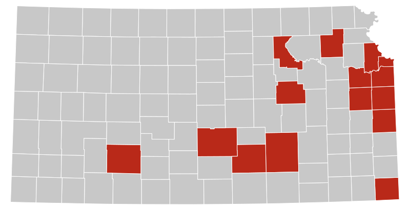
English: Map of Kansas's counties where COVID-19 has been confirmed as of 14 March 2020. As this is a current outbreak, the map might not be up to date.
Confirmed cases |
| ⧼wm-license-information-date⧽ | 2020 |
| ⧼wm-license-information-source⧽ | File:Kansas_Presidential_Election_Results_2016.svg (out of date; source file has been changed) |
| ⧼wm-license-information-author⧽ | Ali Zifan, colored by Aneises |
ترخيص
تاريخ الملف
اضغط على زمن/تاريخ لرؤية الملف كما بدا في هذا الزمن.
| زمن/تاريخ | صورة مصغرة | الأبعاد | مستخدم | تعليق | |
|---|---|---|---|---|---|
| حالي | ★ مراجعة معتمدة 00:26، 2 نوفمبر 2023 | | 2٬351 × 1٬207 (65 كيلوبايت) | Pastakhov (نقاش | مساهمات) | Upload https://upload.wikimedia.org/wikipedia/commons/a/a2/COVID-19_Cases_in_Kansas_by_counties.svg |
لا يمكنك استبدال هذا الملف.
وصلات
لا يوجد صفحات تصل لهذه الصورة.