ملف:Brunswick Park Road - geograph.org.uk - 1512096.jpg
لا توجد دقة أعلى متوفرة.
Brunswick_Park_Road_-_geograph.org.uk_-_1512096.jpg (640 × 407 بكسل حجم الملف: 204 كيلوبايت، نوع MIME: image/jpeg)
وصف قصير
| ⧼wm-license-information-description⧽ |
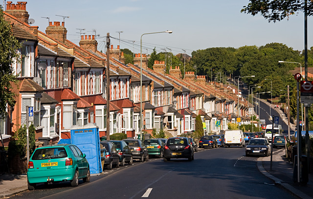
English: Brunswick Park Road The road descends into a valley that was probably created by a tributary of Pymmes Brook - the stream on the North Middlesex Golf Course seems a likely candidate.
At the bottom it passes New Southgate Recreation Ground before climbing again to a summit beside New Southgate Cemetery, hidden in the trees on the horizon.
|
| ⧼wm-license-information-date⧽ | 2009 |
| ⧼wm-license-information-source⧽ | From geograph.org.uk |
| ⧼wm-license-information-author⧽ | Martin Addison |
| ⧼wm-license-cc-attribution⧽ (قالب:I18n/Credit line) |
Martin Addison / Brunswick Park Road / |
51°37′05″N 0°08′27″W / 51.61808°N 0.1409°W قالب:Object location
_heading:337)
ترخيص
تاريخ الملف
اضغط على زمن/تاريخ لرؤية الملف كما بدا في هذا الزمن.
| زمن/تاريخ | صورة مصغرة | الأبعاد | مستخدم | تعليق | |
|---|---|---|---|---|---|
| حالي | ★ مراجعة معتمدة 20:17، 14 نوفمبر 2023 | | 640 × 407 (204 كيلوبايت) | Pastakhov (نقاش | مساهمات) | Upload https://upload.wikimedia.org/wikipedia/commons/a/af/Brunswick_Park_Road_-_geograph.org.uk_-_1512096.jpg |
لا يمكنك استبدال هذا الملف.
وصلات
لا يوجد صفحات تصل لهذه الصورة.