ملف:Borgue Village - geograph.org.uk - 108634.jpg
لا توجد دقة أعلى متوفرة.
Borgue_Village_-_geograph.org.uk_-_108634.jpg (640 × 480 بكسل حجم الملف: 84 كيلوبايت، نوع MIME: image/jpeg)
وصف قصير
| ⧼wm-license-information-description⧽ |
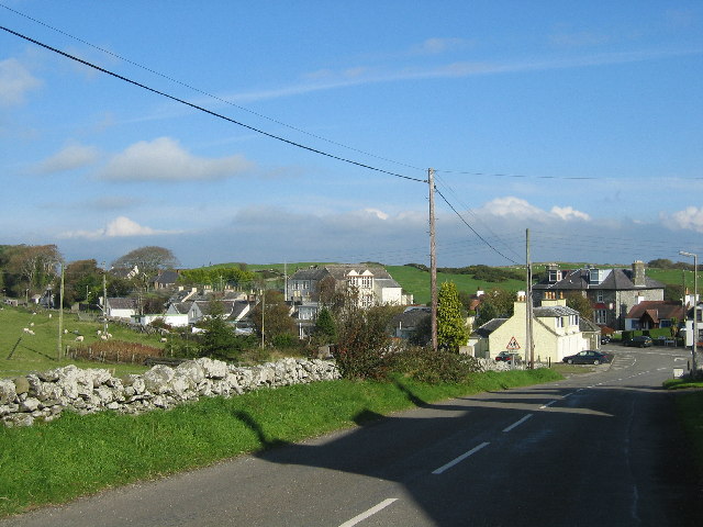
English: Borgue Village. Looking down on Borgue Village from outside the church. The shadows in the road are from the row of houses adjacent to the church. The large building in the centre of the picture is Borgue School - a primary school now but previously a naval academy. The imposing dark grey building further to the right is the Borgue Hotel.
|
| ⧼wm-license-information-date⧽ | 2004 |
| ⧼wm-license-information-source⧽ | From geograph.org.uk |
| ⧼wm-license-information-author⧽ | Madeleine Kirk |
| ⧼wm-license-cc-attribution⧽ (قالب:I18n/Credit line) |
Madeleine Kirk / Borgue Village / |
54°48′40″N 4°08′10″W / 54.8112°N 4.136°W قالب:Object location
)
ترخيص
تاريخ الملف
اضغط على زمن/تاريخ لرؤية الملف كما بدا في هذا الزمن.
| زمن/تاريخ | صورة مصغرة | الأبعاد | مستخدم | تعليق | |
|---|---|---|---|---|---|
| حالي | ★ مراجعة معتمدة 04:52، 27 نوفمبر 2023 | | 640 × 480 (84 كيلوبايت) | Pastakhov (نقاش | مساهمات) | Upload https://upload.wikimedia.org/wikipedia/commons/d/d4/Borgue_Village_-_geograph.org.uk_-_108634.jpg |
لا يمكنك استبدال هذا الملف.
وصلات
لا يوجد صفحات تصل لهذه الصورة.