ملف:Bordeaux canton 5 map.svg

حجم معاينة PNG لذلك الملف ذي الامتداد SVG: 480 × 600 بكسل. البعد الآخر: 1٬638 × 2٬048 بكسل.
الملف الأصلي (ملف SVG، أبعاده 2٬085 × 2٬606 بكسل، حجم الملف: 1٫89 ميجابايت)
وصف قصير
| ⧼wm-license-information-description⧽ |
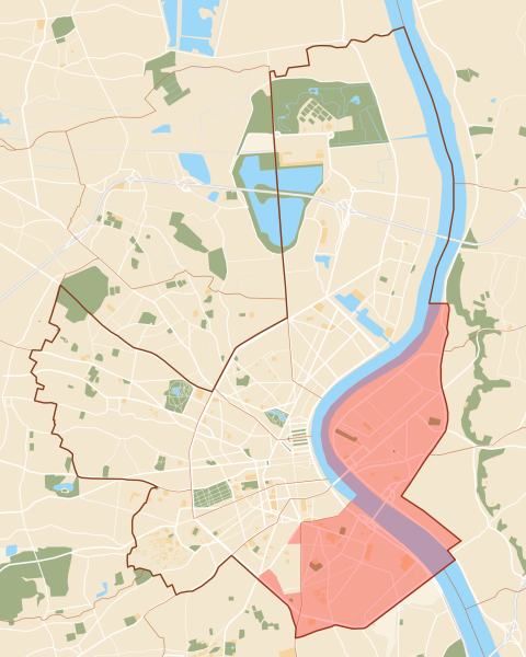
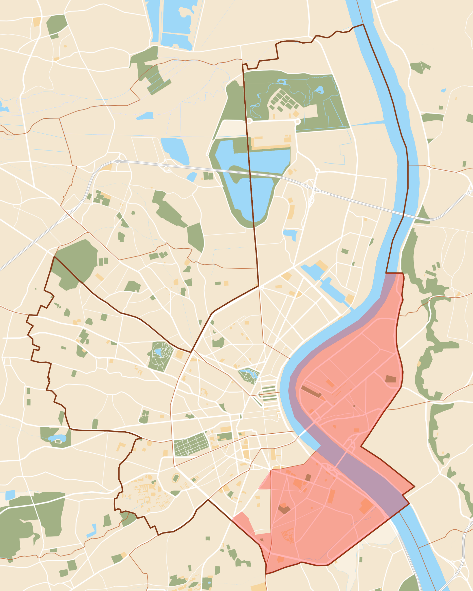
Français : Situation du canton 5 de la ville de Bordeaux (canton créé en 2015).
|
| ⧼wm-license-information-date⧽ | 2015 |
| ⧼wm-license-information-source⧽ | Plan Bordeaux.png by Dark Attsios ; new cantons from plan.bordeaux.fr |
| ⧼wm-license-information-author⧽ | Flappiefh |
ترخيص
|
تاريخ الملف
اضغط على زمن/تاريخ لرؤية الملف كما بدا في هذا الزمن.
| زمن/تاريخ | صورة مصغرة | الأبعاد | مستخدم | تعليق | |
|---|---|---|---|---|---|
| حالي | ★ مراجعة معتمدة 05:15، 16 أكتوبر 2023 | | 2٬085 × 2٬606 (1٫89 ميجابايت) | Pastakhov (نقاش | مساهمات) | Upload https://upload.wikimedia.org/wikipedia/commons/1/1b/Bordeaux_canton_5_map.svg |
لا يمكنك استبدال هذا الملف.
وصلات
لا يوجد صفحات تصل لهذه الصورة.