ملف:Bondari Hill.jpg
حجم هذه المعاينة: 400 × 600 بكسل. البعدان الآخران: 1٬365 × 2٬048 بكسل | 4٬000 × 6٬000 بكسل.
الملف الأصلي (4٬000 × 6٬000 بكسل حجم الملف: 14٫94 ميجابايت، نوع MIME: image/jpeg)
وصف قصير
| ⧼wm-license-information-description⧽ |
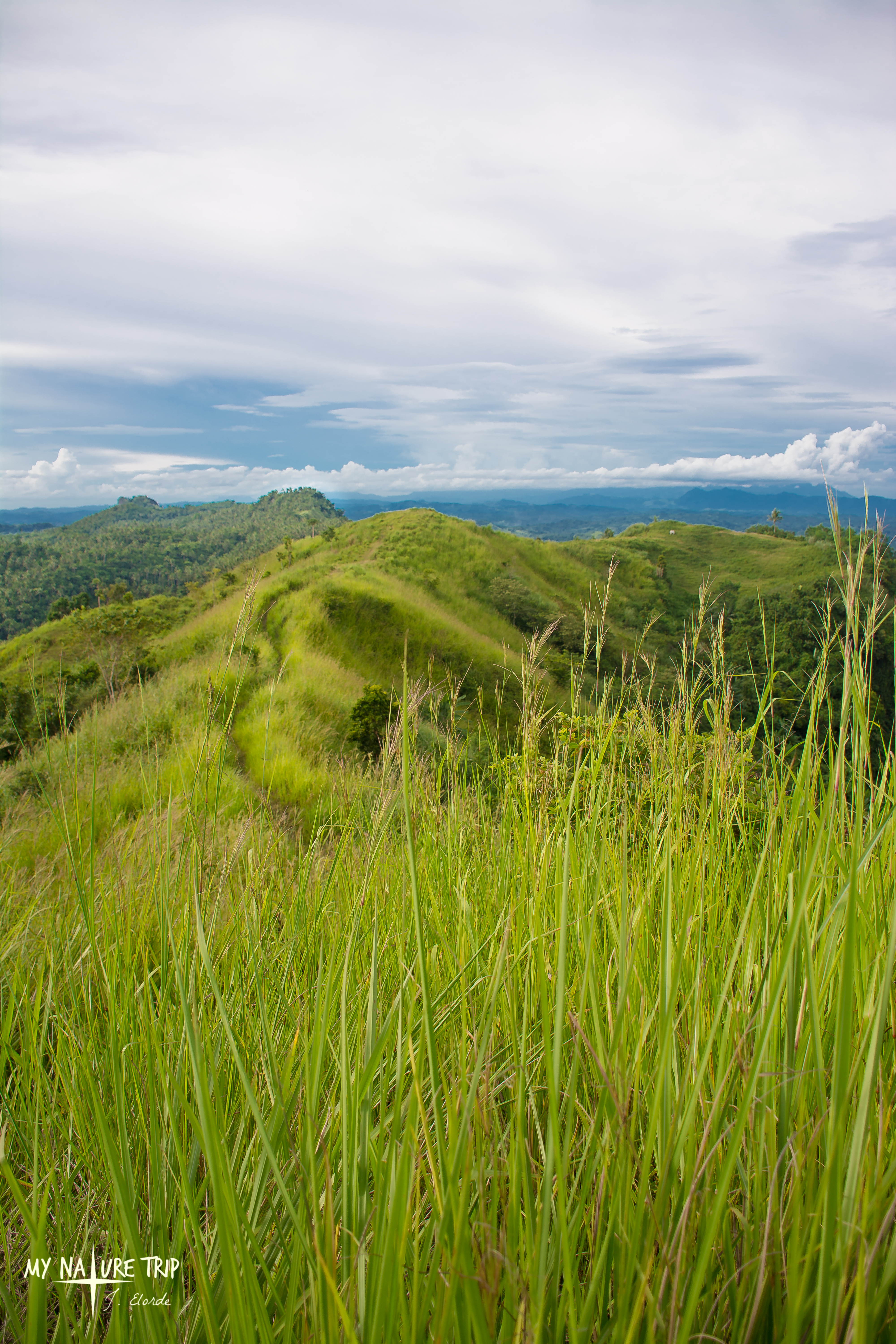
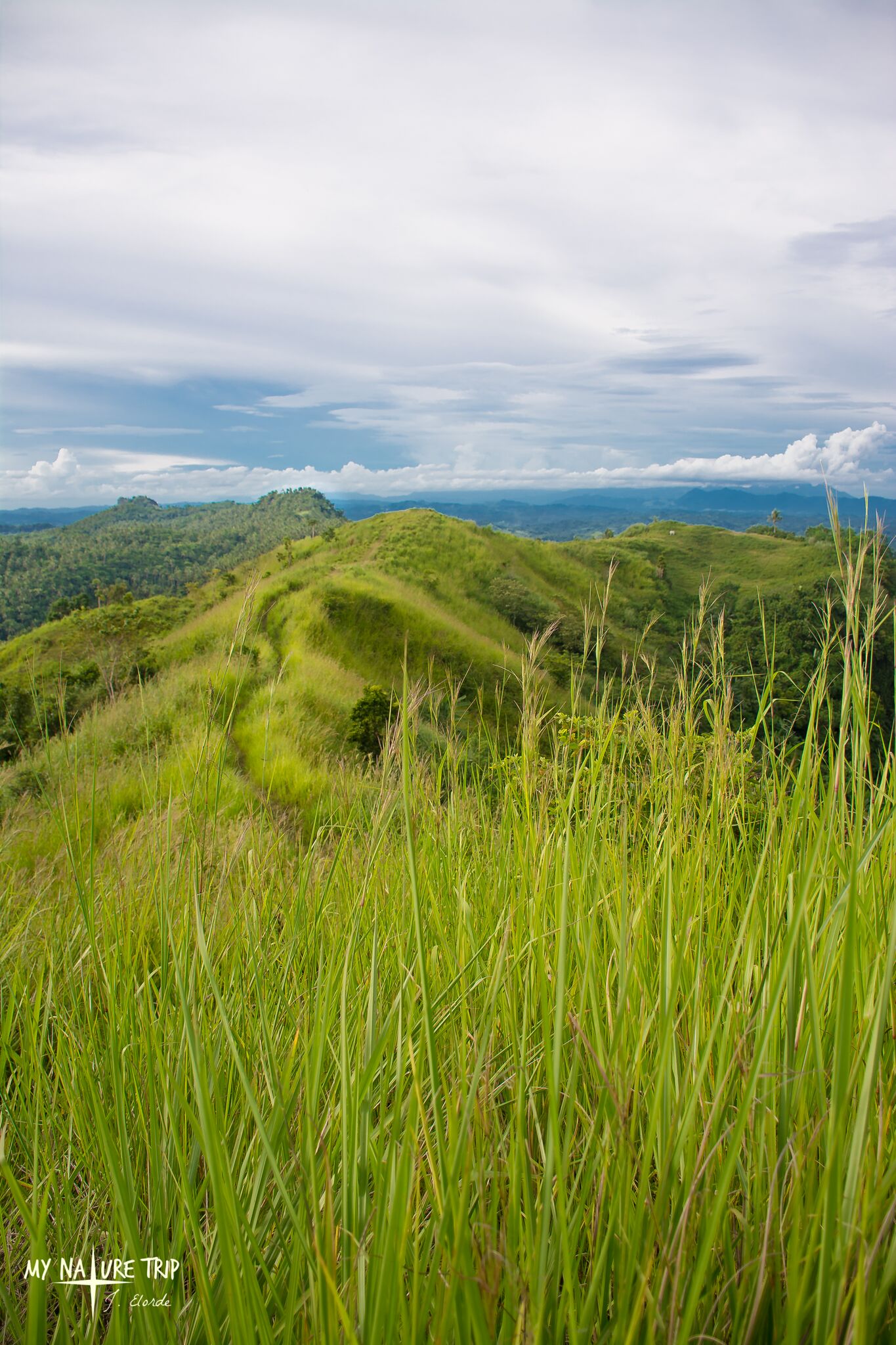
English: With the coordinates of 11°08’47”N 124°25’52”E, the Bondari Peak is located southeast of the municipality of Villaba Leyte and lies 3,756m away from the main barrio of Abijao. With an elevation of 341masl, the place got its name derived from an English word “boundary” because the place is exactly located along municipalities of Villaba and Matag-ob, Leyte and later was changed to Bondari as there’s this story where three hikers asked for the name of the place but the children they met along Tolingon trail pronounced it wrong instead of ‘boundary’ they told the word ‘bondari’, and from that time on, the place retained the name Bondari.
This striking grassy hill is also called Naked Hill because during the summer of 1994, due to extreme heat the dried cogon grass which covered the whole hill caught up with fire revealing its dark brown burnt terrain.
|
| ⧼wm-license-information-date⧽ | 2016, {{time}} – invalid date format 58 (help) |
| ⧼wm-license-information-source⧽ | ⧼Wm-license-own-work⧽ |
| ⧼wm-license-information-author⧽ | Jimielorde |
ترخيص
|
تاريخ الملف
اضغط على زمن/تاريخ لرؤية الملف كما بدا في هذا الزمن.
| زمن/تاريخ | صورة مصغرة | الأبعاد | مستخدم | تعليق | |
|---|---|---|---|---|---|
| حالي | ★ مراجعة معتمدة 22:24، 30 نوفمبر 2023 | | 4٬000 × 6٬000 (14٫94 ميجابايت) | Pastakhov (نقاش | مساهمات) | Upload https://upload.wikimedia.org/wikipedia/commons/5/50/Bondari_Hill.jpg |
لا يمكنك استبدال هذا الملف.
وصلات
لا يوجد صفحات تصل لهذه الصورة.