ملف:Blue Ash south of the airport.jpg

حجم هذه المعاينة: 800 × 600 بكسل. البعد الآخر: 2٬272 × 1٬704 بكسل.
الملف الأصلي (2٬272 × 1٬704 بكسل حجم الملف: 1٫74 ميجابايت، نوع MIME: image/jpeg)
| ⧼wm-license-information-description⧽ |
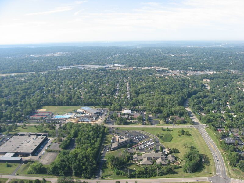
English: Aerial view of Blue Ash, a city near Cincinnati in Hamilton County, Ohio, United States. The major intersection in the bottom right corner is Malsbary Road and the Reed Hartman Highway. Picture taken from a Diamond Eclipse light airplane, preparing to land at the Cincinnati-Blue Ash Airport, from an altitude of 1,740 feet MSL and a bearing of approximately 185º.
|
||
| ⧼wm-license-information-date⧽ | قالب:Taken on | ||
| ⧼wm-license-information-source⧽ | ⧼Wm-license-own-work⧽ | ||
| ⧼wm-license-information-author⧽ | Nyttend | ||
| ⧼wm-license-information-permission⧽ (⧼wm-license-information-permission-reusing-text⧽) |
|
تاريخ الملف
اضغط على زمن/تاريخ لرؤية الملف كما بدا في هذا الزمن.
| زمن/تاريخ | صورة مصغرة | الأبعاد | مستخدم | تعليق | |
|---|---|---|---|---|---|
| حالي | ★ مراجعة معتمدة 17:27، 8 نوفمبر 2023 | | 2٬272 × 1٬704 (1٫74 ميجابايت) | Pastakhov (نقاش | مساهمات) | Upload https://upload.wikimedia.org/wikipedia/commons/6/6a/Blue_Ash_south_of_the_airport.jpg |
لا يمكنك استبدال هذا الملف.
وصلات
لا يوجد صفحات تصل لهذه الصورة.