ملف:Blore Ray St Bartholomew Church - geograph.org.uk - 366256.jpg
لا توجد دقة أعلى متوفرة.
Blore_Ray_St_Bartholomew_Church_-_geograph.org.uk_-_366256.jpg (640 × 428 بكسل حجم الملف: 127 كيلوبايت، نوع MIME: image/jpeg)
وصف قصير
| ⧼wm-license-information-description⧽ |
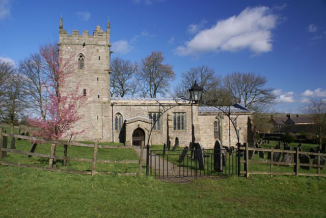
English: Blore Ray St Bartholomew Church Complete with burning bush! This grade 1 listed church dates from the early 12th Century. It remains unchanged since this time, although it underwent some repairs in 1840. The buildings to the right of the church, belong to Bore Hall, once the home of the Bassett family.
|
| ⧼wm-license-information-date⧽ | 2007 |
| ⧼wm-license-information-source⧽ | From geograph.org.uk |
| ⧼wm-license-information-author⧽ | Nikki Mahadevan |
| ⧼wm-license-cc-attribution⧽ (قالب:I18n/Credit line) |
Nikki Mahadevan / Blore Ray St Bartholomew Church / |
53°02′27″N 1°47′49″W / 53.04075°N 1.7969°W قالب:Object location
_heading:0)
ترخيص
تاريخ الملف
اضغط على زمن/تاريخ لرؤية الملف كما بدا في هذا الزمن.
| زمن/تاريخ | صورة مصغرة | الأبعاد | مستخدم | تعليق | |
|---|---|---|---|---|---|
| حالي | ★ مراجعة معتمدة 20:35، 21 أكتوبر 2023 | | 640 × 428 (127 كيلوبايت) | Pastakhov (نقاش | مساهمات) | Upload https://upload.wikimedia.org/wikipedia/commons/b/bf/Blore_Ray_St_Bartholomew_Church_-_geograph.org.uk_-_366256.jpg |
لا يمكنك استبدال هذا الملف.
وصلات
لا يوجد صفحات تصل لهذه الصورة.