ملف:Berlin-Tegel Karte.png
حجم هذه المعاينة: 484 × 600 بكسل. البعد الآخر: 1٬458 × 1٬807 بكسل.
الملف الأصلي (1٬458 × 1٬807 بكسل حجم الملف: 1٫52 ميجابايت، نوع MIME: image/png)
وصف قصير
| ⧼wm-license-information-description⧽ |
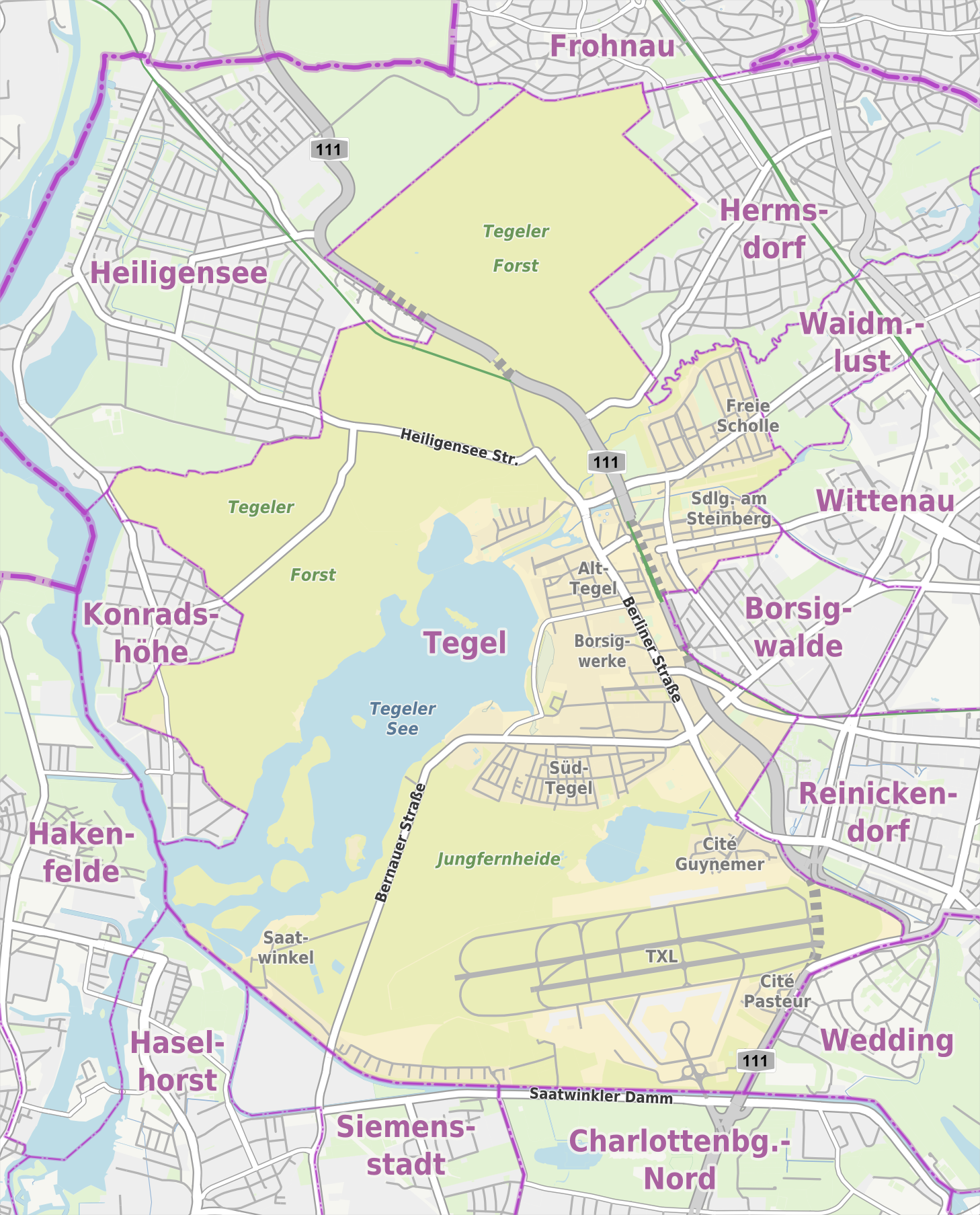
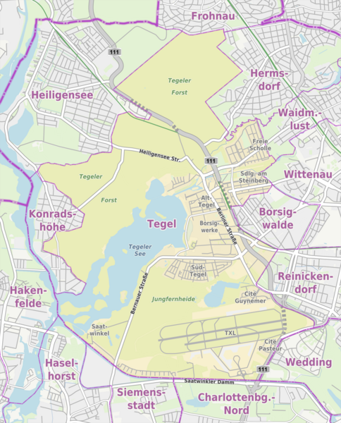
Übersichtskarte der Straßen und Ortslagen in Berlin-Tegel |
| ⧼wm-license-information-date⧽ | 2013 |
| ⧼wm-license-information-source⧽ | own work, using
|
| ⧼wm-license-information-author⧽ | Alexrk2 |
| ⧼wm-license-information-permission⧽ (⧼wm-license-information-permission-reusing-text⧽) |
ترخيص
|
تاريخ الملف
اضغط على زمن/تاريخ لرؤية الملف كما بدا في هذا الزمن.
| زمن/تاريخ | صورة مصغرة | الأبعاد | مستخدم | تعليق | |
|---|---|---|---|---|---|
| حالي | ★ مراجعة معتمدة 11:55، 30 أكتوبر 2023 | | 1٬458 × 1٬807 (1٫52 ميجابايت) | Pastakhov (نقاش | مساهمات) | Upload https://upload.wikimedia.org/wikipedia/commons/9/98/Berlin-Tegel_Karte.png |
لا يمكنك استبدال هذا الملف.
وصلات
لا يوجد صفحات تصل لهذه الصورة.