ملف:Babilonia durante la dinastía Casitas Siglo XIII adC ES.svg

حجم معاينة PNG لذلك الملف ذي الامتداد SVG: 658 × 576 بكسل. البعد الآخر: 2٬340 × 2٬048 بكسل.
الملف الأصلي (ملف SVG، أبعاده 658 × 576 بكسل، حجم الملف: 173 كيلوبايت)
وصف قصير
| ⧼wm-license-information-description⧽ |
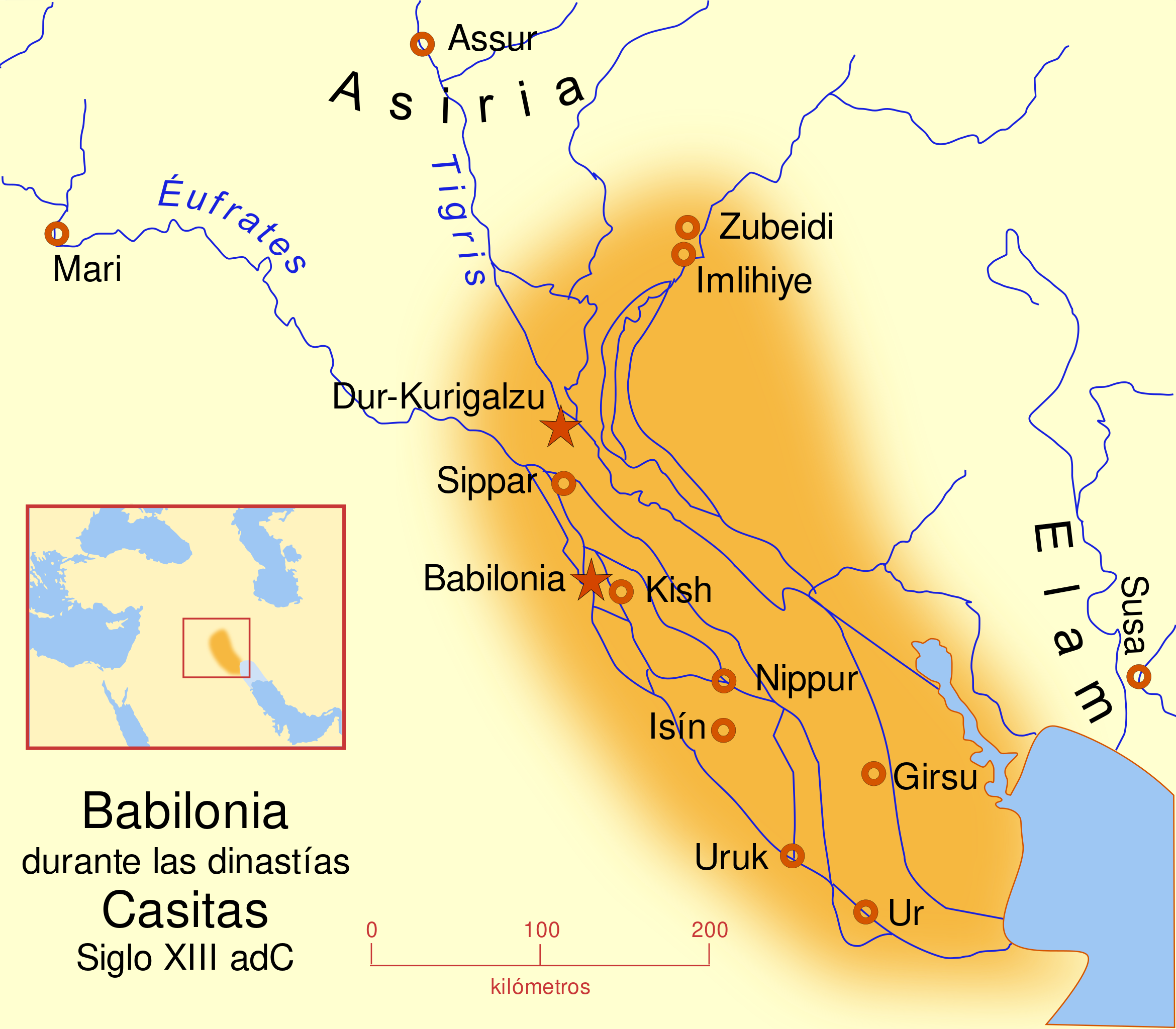
Español: Babilonia durante la dinastía Casita. Siglo XIII a. C.
A map of the Babylonian Empire during the time of the Kassites, roughly the 13th century BC. This map shows the probable river courses and coastline at that time. |
| ⧼wm-license-information-date⧽ | 2008 |
| ⧼wm-license-information-source⧽ | ⧼Wm-license-own-work⧽ |
| ⧼wm-license-information-author⧽ | MapMaster |
| ⧼wm-license-information-other-versions⧽ |
|
Other versions
Similar maps
References
- Roaf, M. (1990) Cultural Atlas of Mesopotamia and the ancient Near East, Oxford: Facts on File. (In general, the basis for the ancient river courses and ancient coastline).
ترخيص
|

تاريخ الملف
اضغط على زمن/تاريخ لرؤية الملف كما بدا في هذا الزمن.
| زمن/تاريخ | صورة مصغرة | الأبعاد | مستخدم | تعليق | |
|---|---|---|---|---|---|
| حالي | ★ مراجعة معتمدة 13:29، 8 نوفمبر 2023 | | 658 × 576 (173 كيلوبايت) | Pastakhov (نقاش | مساهمات) | Upload https://upload.wikimedia.org/wikipedia/commons/f/f8/Babilonia_durante_la_dinast%C3%ADa_Casitas_Siglo_XIII_adC_ES.svg |
لا يمكنك استبدال هذا الملف.
وصلات
لا يوجد صفحات تصل لهذه الصورة.