ملف:Aylesbury, Penn Road, California - geograph.org.uk - 898429.jpg
لا توجد دقة أعلى متوفرة.
Aylesbury,_Penn_Road,_California_-_geograph.org.uk_-_898429.jpg (640 × 480 بكسل حجم الملف: 67 كيلوبايت، نوع MIME: image/jpeg)
وصف قصير
| ⧼wm-license-information-description⧽ |
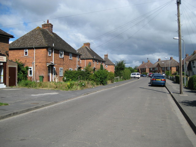
English: Aylesbury: Penn Road, California California seems to have developed as the result of the construction of a printing works between Bear Brook and California Brook in Victorian times. Penn Road was the first residential street to be developed in the area, which later expanded into the massive suburban sprawl of the Southchurch estate.
|
| ⧼wm-license-information-date⧽ | 2008 |
| ⧼wm-license-information-source⧽ | From geograph.org.uk |
| ⧼wm-license-information-author⧽ | Nigel Cox |
| ⧼wm-license-cc-attribution⧽ (قالب:I18n/Credit line) |
Nigel Cox / Aylesbury: Penn Road, California / |
51°48′43″N 0°48′58″W / 51.8119°N 0.816°W قالب:Object location
_heading:315)
ترخيص
تاريخ الملف
اضغط على زمن/تاريخ لرؤية الملف كما بدا في هذا الزمن.
| زمن/تاريخ | صورة مصغرة | الأبعاد | مستخدم | تعليق | |
|---|---|---|---|---|---|
| حالي | ★ مراجعة معتمدة 21:36، 26 ديسمبر 2023 | | 640 × 480 (67 كيلوبايت) | Pastakhov (نقاش | مساهمات) | Upload https://upload.wikimedia.org/wikipedia/commons/6/61/Aylesbury%2C_Penn_Road%2C_California_-_geograph.org.uk_-_898429.jpg |
لا يمكنك استبدال هذا الملف.
وصلات
لا يوجد صفحات تصل لهذه الصورة.