ملف:Atlantic Road, Brixton, South London - geograph.org.uk - 468413.jpg
لا توجد دقة أعلى متوفرة.
Atlantic_Road,_Brixton,_South_London_-_geograph.org.uk_-_468413.jpg (640 × 529 بكسل حجم الملف: 92 كيلوبايت، نوع MIME: image/jpeg)
وصف قصير
| ⧼wm-license-information-description⧽ |
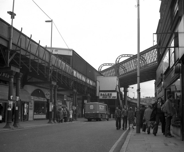
English: Atlantic Road, Brixton, South London Lively shopping street near the centre of Brixton. Brixton station is above on the left, while another railway, which has no station just here, crosses at a higher level by a lattice-girder bridge. Brixton Underground station on the Victoria line is just nearby to the right.
|
| ⧼wm-license-information-date⧽ | 1978 |
| ⧼wm-license-information-source⧽ | From geograph.org.uk |
| ⧼wm-license-information-author⧽ | Dr Neil Clifton |
| ⧼wm-license-cc-attribution⧽ (قالب:I18n/Credit line) |
Dr Neil Clifton / Atlantic Road, Brixton, South London / |
51°27′48″N 0°06′55″W / 51.46336°N 0.1153°W قالب:Object location
_heading:67)
ترخيص
تاريخ الملف
اضغط على زمن/تاريخ لرؤية الملف كما بدا في هذا الزمن.
| زمن/تاريخ | صورة مصغرة | الأبعاد | مستخدم | تعليق | |
|---|---|---|---|---|---|
| حالي | ★ مراجعة معتمدة 15:03، 4 ديسمبر 2023 | | 640 × 529 (92 كيلوبايت) | Pastakhov (نقاش | مساهمات) | Upload https://upload.wikimedia.org/wikipedia/commons/b/b0/Atlantic_Road%2C_Brixton%2C_South_London_-_geograph.org.uk_-_468413.jpg |
لا يمكنك استبدال هذا الملف.
وصلات
لا يوجد صفحات تصل لهذه الصورة.