ملف:Arthuret Parish Church - geograph.org.uk - 17681.jpg
لا توجد دقة أعلى متوفرة.
Arthuret_Parish_Church_-_geograph.org.uk_-_17681.jpg (640 × 411 بكسل حجم الملف: 100 كيلوبايت، نوع MIME: image/jpeg)
وصف قصير
| ⧼wm-license-information-description⧽ |
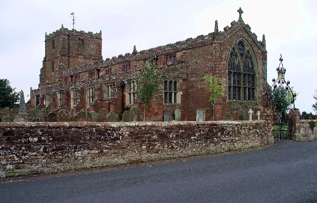
English: Arthuret Parish Church. Arthuret Church, about half a mile south of Longtown, dates from 1609. The name may be a corruption of "Arthur's Head", the name given to the land on which it is built. The area has many associations with King Arthur, and it is rumoured that his head is buried at Arthuret.
|
| ⧼wm-license-information-date⧽ | 2003 |
| ⧼wm-license-information-source⧽ | From geograph.org.uk |
| ⧼wm-license-information-author⧽ | Lynne Kirton |
| ⧼wm-license-cc-attribution⧽ (قالب:I18n/Credit line) |
Lynne Kirton / Arthuret Parish Church / |
ترخيص
تاريخ الملف
اضغط على زمن/تاريخ لرؤية الملف كما بدا في هذا الزمن.
| زمن/تاريخ | صورة مصغرة | الأبعاد | مستخدم | تعليق | |
|---|---|---|---|---|---|
| حالي | ★ مراجعة معتمدة 04:47، 28 أكتوبر 2023 | | 640 × 411 (100 كيلوبايت) | Pastakhov (نقاش | مساهمات) | Upload https://upload.wikimedia.org/wikipedia/commons/1/13/Arthuret_Parish_Church_-_geograph.org.uk_-_17681.jpg |
لا يمكنك استبدال هذا الملف.
وصلات
لا يوجد صفحات تصل لهذه الصورة.