ملف:Arthur Kill Pralls Island.jpg
حجم هذه المعاينة: 800 × 533 بكسل. البعدان الآخران: 2٬560 × 1٬707 بكسل | 3٬504 × 2٬336 بكسل.
الملف الأصلي (3٬504 × 2٬336 بكسل حجم الملف: 7٫45 ميجابايت، نوع MIME: image/jpeg)
وصف قصير
| ⧼wm-license-information-description⧽ |
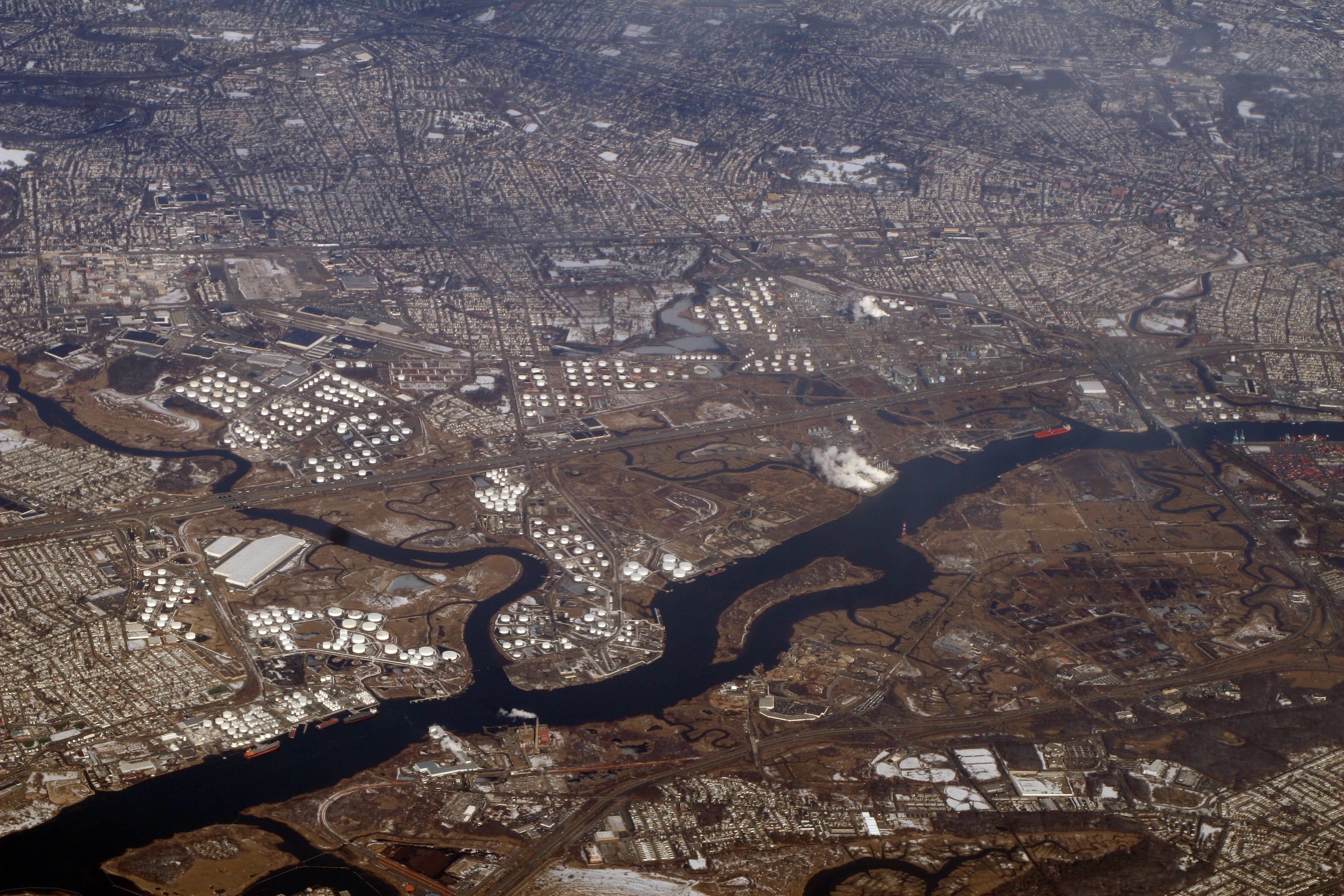
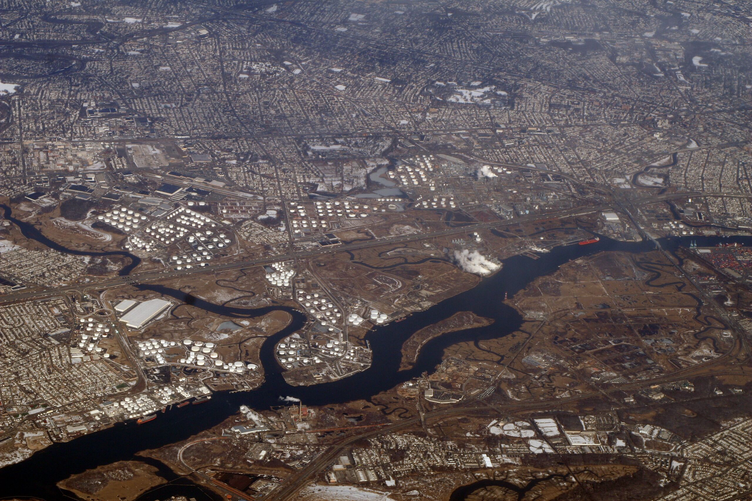
English: The Arthur Kill is a tidal strait that separates New Jersey (above) from Staten Island (below). Outerbridge Crossing (NJ/NY highway 440) connects the two, at the south end of Staten Island. Crossing its north end is the Goethals Bridge. The water body perpendicular to the Arthur Kill in New Jersey is the Rahway River. which divides Carteret on the south (left) and Linden on the north. The island in Arthur Kill is Prall's Island.
Deutsch: Der Kanal Arthur Kill trennt New Jersey (oben) von Staten Island (unten). Prall's Island befindet sich im Kanal
|
| ⧼wm-license-information-date⧽ | 2010 |
| ⧼wm-license-information-source⧽ | https://www.flickr.com/photos/docsearls/4394572429/ |
| ⧼wm-license-information-author⧽ | dsearls |
ترخيص
تاريخ الملف
اضغط على زمن/تاريخ لرؤية الملف كما بدا في هذا الزمن.
| زمن/تاريخ | صورة مصغرة | الأبعاد | مستخدم | تعليق | |
|---|---|---|---|---|---|
| حالي | ★ مراجعة معتمدة 08:28، 5 نوفمبر 2023 | | 3٬504 × 2٬336 (7٫45 ميجابايت) | Pastakhov (نقاش | مساهمات) | Upload https://upload.wikimedia.org/wikipedia/commons/c/c5/Arthur_Kill_Pralls_Island.jpg |
لا يمكنك استبدال هذا الملف.
وصلات
الصفحات التالية تحتوي على وصلة لهذه الصورة: