ملف:Arlington Road, Camden Town - geograph.org.uk - 647224.jpg
لا توجد دقة أعلى متوفرة.
Arlington_Road,_Camden_Town_-_geograph.org.uk_-_647224.jpg (640 × 480 بكسل حجم الملف: 116 كيلوبايت، نوع MIME: image/jpeg)
وصف قصير
| ⧼wm-license-information-description⧽ |
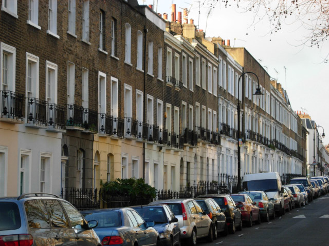
English: Arlington Road, Camden Town Arlington Road runs parallel with and to the west of Camden High Street. It was named after the Earl of Arlington, a favourite of Charles II - the Earl's daughter married the King's son, Henry Fitzroy, who became the first Duke of Grafton. The houses here are early Victorian, dating from about 1839.
|
| ⧼wm-license-information-date⧽ | 2008 |
| ⧼wm-license-information-source⧽ | From geograph.org.uk |
| ⧼wm-license-information-author⧽ | Stephen McKay |
| ⧼wm-license-cc-attribution⧽ (قالب:I18n/Credit line) |
Stephen McKay / Arlington Road, Camden Town / |
51°32′08″N 0°08′27″W / 51.53553°N 0.1408°W قالب:Object location
_heading:270)
ترخيص
تاريخ الملف
اضغط على زمن/تاريخ لرؤية الملف كما بدا في هذا الزمن.
| زمن/تاريخ | صورة مصغرة | الأبعاد | مستخدم | تعليق | |
|---|---|---|---|---|---|
| حالي | ★ مراجعة معتمدة 19:08، 14 أكتوبر 2023 | | 640 × 480 (116 كيلوبايت) | Pastakhov (نقاش | مساهمات) | Upload https://upload.wikimedia.org/wikipedia/commons/2/22/Arlington_Road%2C_Camden_Town_-_geograph.org.uk_-_647224.jpg |
لا يمكنك استبدال هذا الملف.
وصلات
لا يوجد صفحات تصل لهذه الصورة.