ملف:Arizona State Route 68, near Laughlin, Nevada (2639399351).jpg
الملف الأصلي (1٬600 × 1٬200 بكسل حجم الملف: 691 كيلوبايت، نوع MIME: image/jpeg)
وصف قصير
| ⧼wm-license-information-description⧽ |
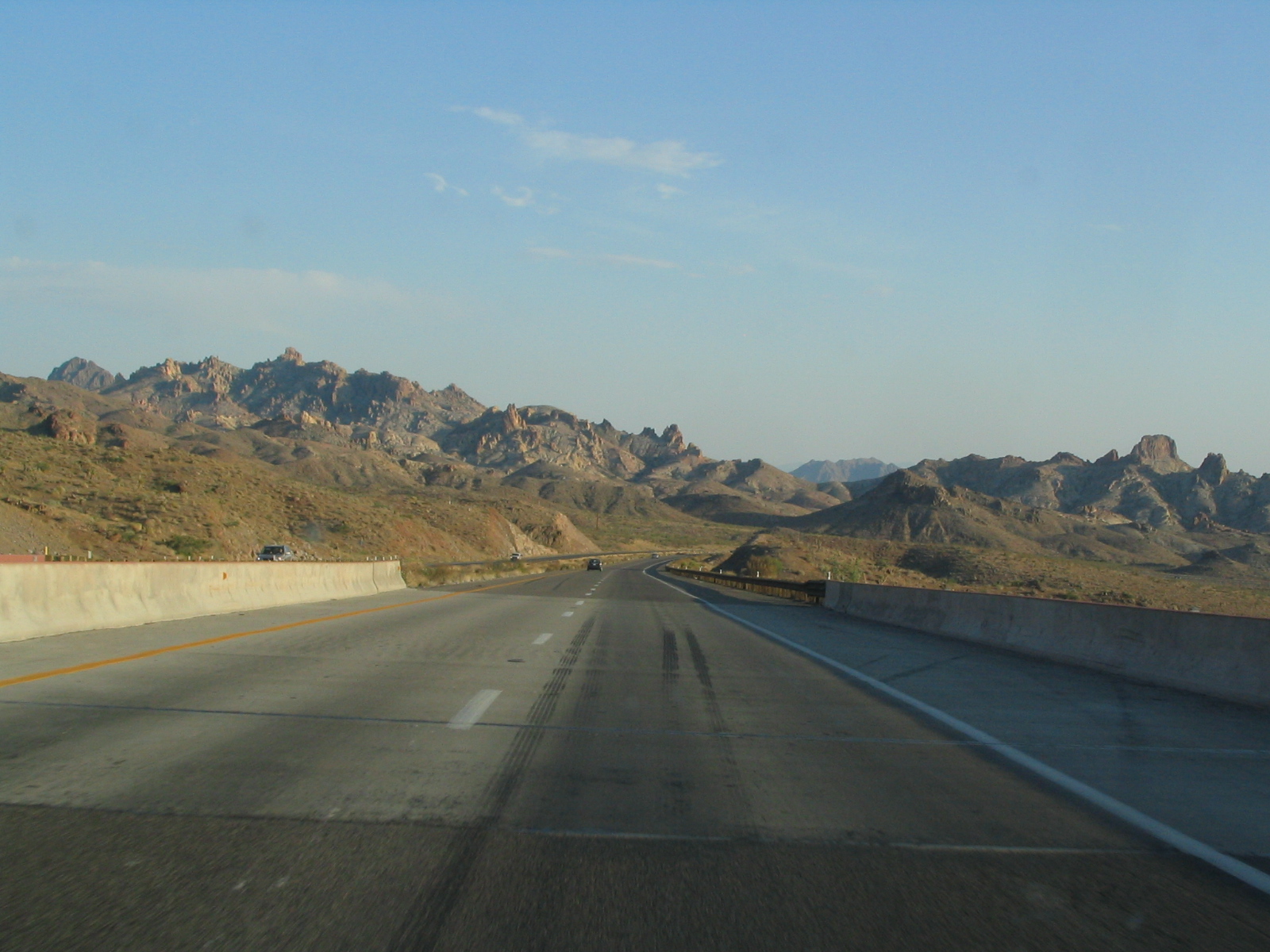
State Route 68, also known as SR 68, is an east–west highway in northwestern Arizona running from its western terminus at its junction with State Route 95 in Bullhead City to a grade-separated interchange at U.S. Route 93 northwest of Kingman. The western terminus formerly extended just to the west of its current point to Davis Dam; this is now numbered as Mohave County Road 68. The primary purpose of this route is to carry traffic to Bullhead City and Laughlin, Nevada. Since September 11, 2001, the highway had also composed part of the mandatory detour for trucks and recreational vehicles traveling between Arizona and Las Vegas, Nevada via US 93, due to the heavy vehicle restrictions over Hoover Dam. The detour was temporary and was removed in 2010, when the new bypass was completed south of the dam . <a href="http://en.wikipedia.org/wiki/Arizona_State_Route_68" rel="nofollow">en.wikipedia.org/wiki/Arizona_State_Route_68</a> en.wikipedia.org/wiki/Wikipedia:Text_of_Creative_Commons_... |
| ⧼wm-license-information-date⧽ | 2008, {{time}} – invalid date format 52 (help) |
| ⧼wm-license-information-source⧽ | Arizona State Route 68, near Laughlin, Nevada |
| ⧼wm-license-information-author⧽ | Ken Lund from Reno, Nevada, USA |
ترخيص
تاريخ الملف
اضغط على زمن/تاريخ لرؤية الملف كما بدا في هذا الزمن.
| زمن/تاريخ | صورة مصغرة | الأبعاد | مستخدم | تعليق | |
|---|---|---|---|---|---|
| حالي | ★ مراجعة معتمدة 07:26، 12 نوفمبر 2023 | | 1٬600 × 1٬200 (691 كيلوبايت) | Pastakhov (نقاش | مساهمات) | Upload https://upload.wikimedia.org/wikipedia/commons/2/2c/Arizona_State_Route_68%2C_near_Laughlin%2C_Nevada_%282639399351%29.jpg |
لا يمكنك استبدال هذا الملف.
وصلات
لا يوجد صفحات تصل لهذه الصورة.
.jpg&oldid=3483702)