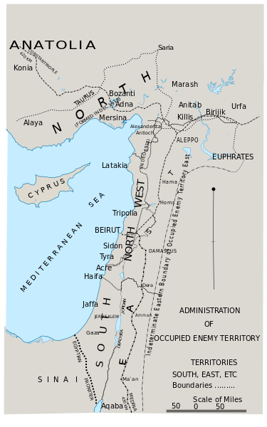
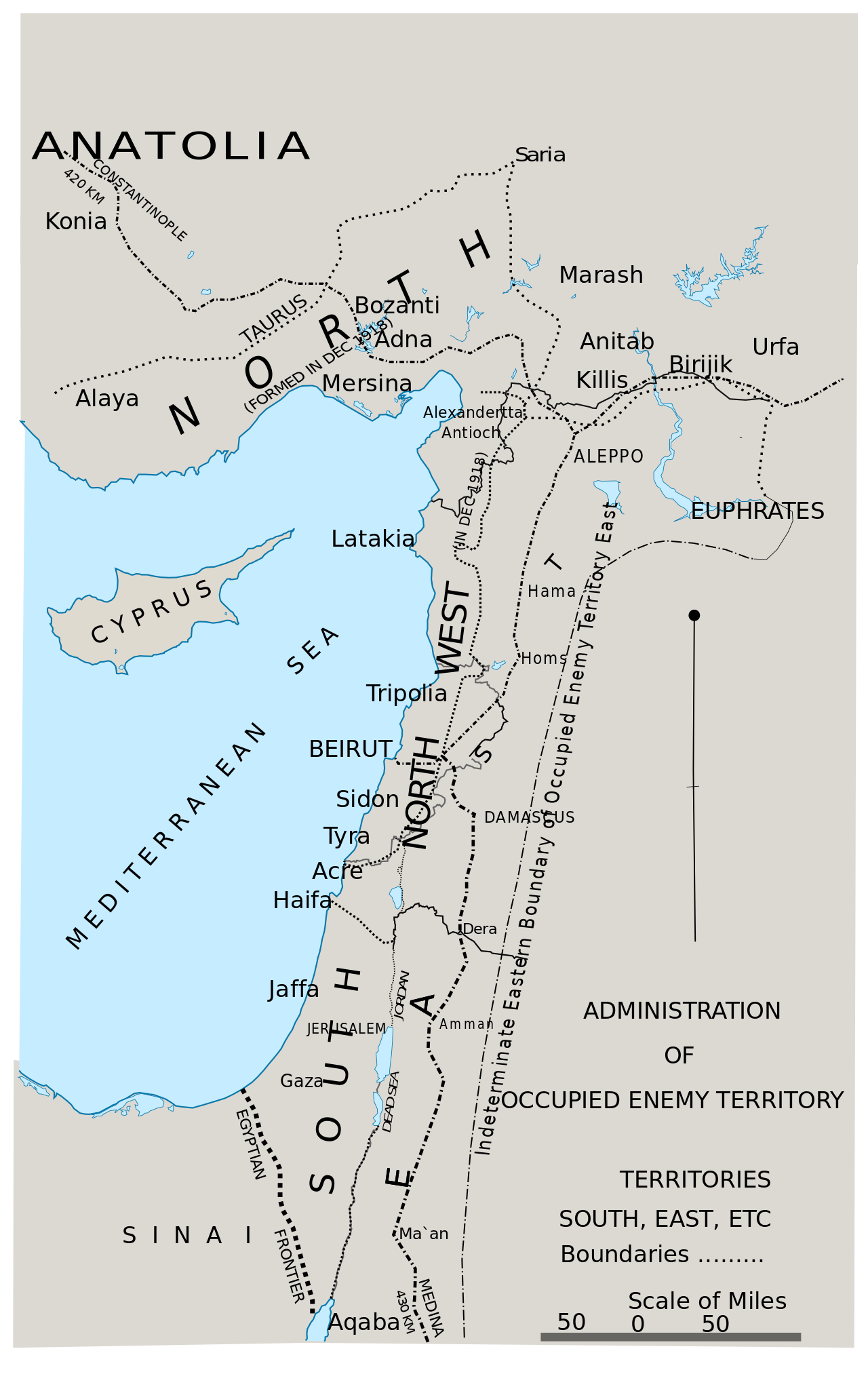
ملف:Area of the OETA.svg

حجم معاينة PNG لذلك الملف ذي الامتداد SVG: 375 × 600 بكسل. البعد الآخر: 1٬280 × 2٬048 بكسل.
الملف الأصلي (ملف SVG، أبعاده 1٬500 × 2٬400 بكسل، حجم الملف: 87 كيلوبايت)
وصف قصير
| ⧼wm-license-information-description⧽ |
English: Administration of occupied territory in SVG
|
| ⧼wm-license-information-date⧽ | 2020 |
| ⧼wm-license-information-source⧽ | Official History of the Great War Based on Official Documents by Direction of the Historical Section of the Committee of Imperial Defence; Military Operations Egypt & Palestine from June 1917 to the End of the War Vol. 2 Part II From File:FallsSkMap42Admin.jpeg |
| ⧼wm-license-information-author⧽ | SPQR10 |
ترخيص
|
تاريخ الملف
اضغط على زمن/تاريخ لرؤية الملف كما بدا في هذا الزمن.
| زمن/تاريخ | صورة مصغرة | الأبعاد | مستخدم | تعليق | |
|---|---|---|---|---|---|
| حالي | ★ مراجعة معتمدة 10:18، 6 نوفمبر 2023 | | 1٬500 × 2٬400 (87 كيلوبايت) | Pastakhov (نقاش | مساهمات) | Upload https://upload.wikimedia.org/wikipedia/commons/c/c9/Area_of_the_OETA.svg |
لا يمكنك استبدال هذا الملف.
وصلات
لا يوجد صفحات تصل لهذه الصورة.