ملف:Antarctica (6), Laubeuf Fjord, Webb Island.JPG
حجم هذه المعاينة: 800 × 339 بكسل. البعد الآخر: 2٬144 × 908 بكسل.
الملف الأصلي (2٬144 × 908 بكسل حجم الملف: 402 كيلوبايت، نوع MIME: image/jpeg)
وصف قصير
| ⧼wm-license-information-description⧽ |
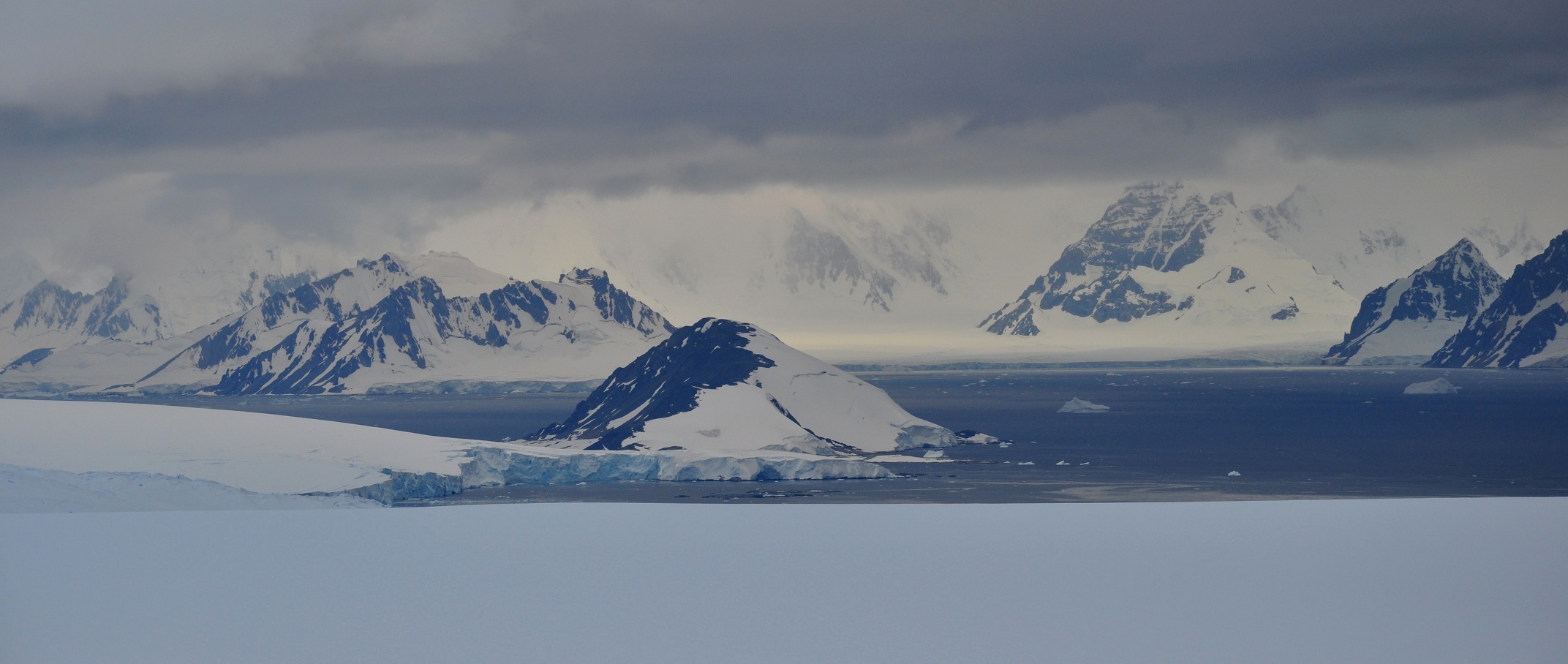
English: Laubeuf Fjord in the Antarctic Peninsula region, seen from a position high on the Wormald Ice Piedmont on Adelaide Island. Viewing direction is toward the NE. In the centre, behind some of the ice cliffs of the piedmont, is Webb Island. Left of Webb Island and further away is Wyatt Island. All the mountains in the background are on the Arrowsmith Peninsula, which is part of the Loubet Coast of the Antarctic Peninsula. The dark mountains at the right edge are the northernmost peaks of the Haslam Heights. The long front of coastal ice cliffs left of these peaks are the mouths of the Vallot Glacier and Ward Glacier. The large mountain behind this ice front is Pryor Peak; it is more than 1000 m high and is part of the Tyndall Mountains.
|
| ⧼wm-license-information-date⧽ | 2011 |
| ⧼wm-license-information-source⧽ | ⧼Wm-license-own-work⧽ |
| ⧼wm-license-information-author⧽ | Vincent van Zeijst |
•67°32′43.13″S 68°11′11.92″W / 67.5453139°S 68.1866444°W Viewing direction is toward the NE.
,_Laubeuf_Fjord,_Webb_Island.JPG¶ms=67_32_43.13_S_68_11_11.92_W_heading:NE)
ترخيص
|
تاريخ الملف
اضغط على زمن/تاريخ لرؤية الملف كما بدا في هذا الزمن.
| زمن/تاريخ | صورة مصغرة | الأبعاد | مستخدم | تعليق | |
|---|---|---|---|---|---|
| حالي | ★ مراجعة معتمدة 19:46، 10 نوفمبر 2023 | | 2٬144 × 908 (402 كيلوبايت) | Pastakhov (نقاش | مساهمات) | Upload https://upload.wikimedia.org/wikipedia/commons/7/7b/Antarctica_%286%29%2C_Laubeuf_Fjord%2C_Webb_Island.JPG |
لا يمكنك استبدال هذا الملف.
وصلات
لا يوجد صفحات تصل لهذه الصورة.
,_Laubeuf_Fjord,_Webb_Island.JPG&oldid=3453148)