ملف:Anoka Cnty Minnesota Incorporated and Unincorporated areas Linwood Highlighted.png
لا توجد دقة أعلى متوفرة.
Anoka_Cnty_Minnesota_Incorporated_and_Unincorporated_areas_Linwood_Highlighted.png (800 × 550 بكسل حجم الملف: 74 كيلوبايت، نوع MIME: image/png)
وصف قصير
| ⧼wm-license-information-description⧽ |
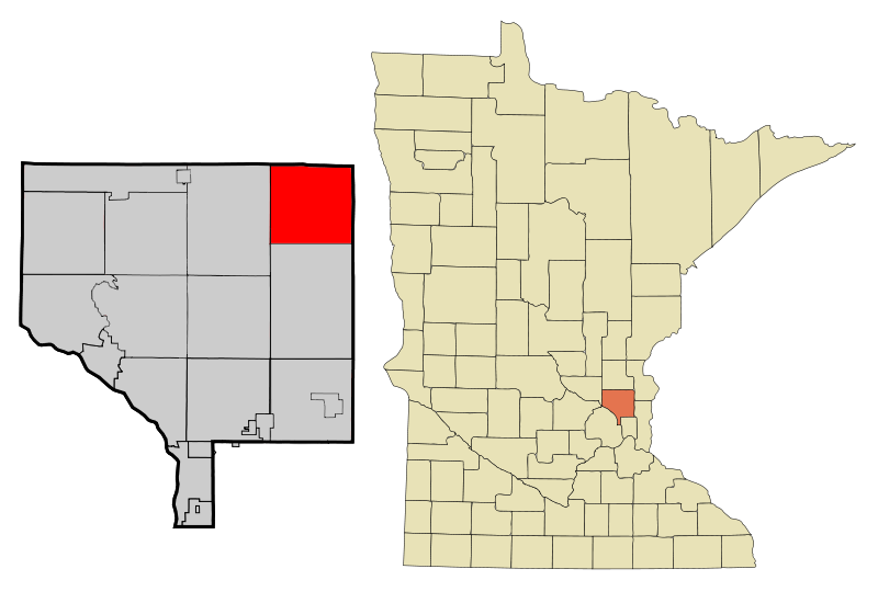
English: This map shows the incorporated and unincorporated areas in Anoka County, highlighting Linwood in red. This file has been updated to reflect the recent incorporation of new municipalities.
|
| ⧼wm-license-information-date⧽ | 2009 |
| ⧼wm-license-information-source⧽ | Based on older versions by Arkyan. |
| ⧼wm-license-information-author⧽ | 123dieinafire |
ترخيص
قالب:Original upload log
قالب:Transferred from قالب:Original description
- 2009-09-25 10:36 123dieinafire 800×550× (75883 bytes) {{Information |Description = This map shows the incorporated and unincorporated areas in [[Anoka County, Minnesota]], highlighting Linwood in red. This file has been updated to reflect the recent incorporation of new munici
تاريخ الملف
اضغط على زمن/تاريخ لرؤية الملف كما بدا في هذا الزمن.
| زمن/تاريخ | صورة مصغرة | الأبعاد | مستخدم | تعليق | |
|---|---|---|---|---|---|
| حالي | ★ مراجعة معتمدة 00:30، 31 أكتوبر 2023 | | 800 × 550 (74 كيلوبايت) | Pastakhov (نقاش | مساهمات) | Upload https://upload.wikimedia.org/wikipedia/commons/9/9b/Anoka_Cnty_Minnesota_Incorporated_and_Unincorporated_areas_Linwood_Highlighted.png |
لا يمكنك استبدال هذا الملف.
وصلات
لا يوجد صفحات تصل لهذه الصورة.