ملف:Ann Arbor Municipal Airport Diagram.JPG
حجم هذه المعاينة: 419 × 599 بكسل. البعد الآخر: 1٬554 × 2٬223 بكسل.
الملف الأصلي (1٬554 × 2٬223 بكسل حجم الملف: 264 كيلوبايت، نوع MIME: image/jpeg)
وصف قصير
| ⧼wm-license-information-description⧽ |
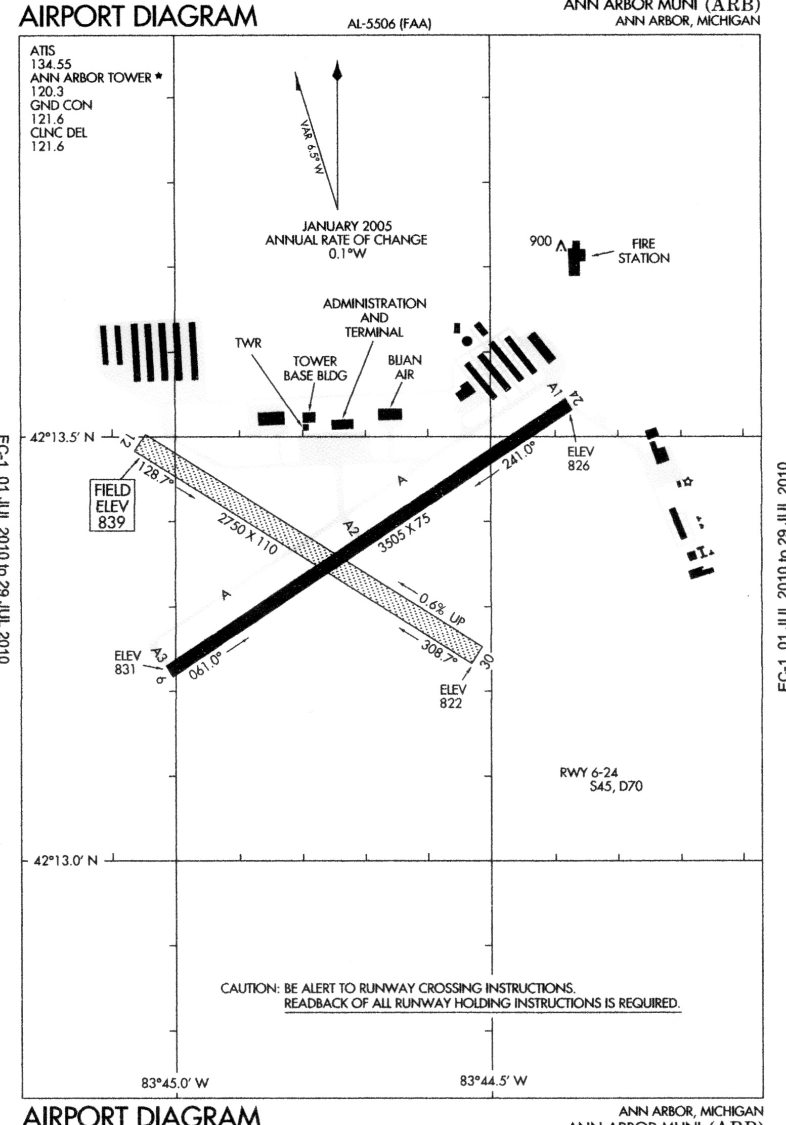
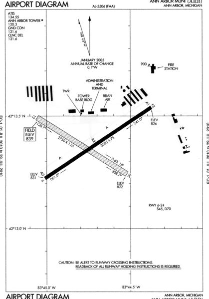
English: FAA airport diagram for ARB (Ann Arbor Municipal Airport) in Michigan, United States.
|
| ⧼wm-license-information-date⧽ | 2010 |
| ⧼wm-license-information-source⧽ | www.faa.gov |
| ⧼wm-license-information-author⧽ | United States Federal Aviation Administration |
ترخيص
قالب:Original upload log
قالب:Original description page
- 2010-07-11 14:06 Dwight Burdette 1554×2223× (270476 bytes) My first upload of the image was the wrong one
- 2010-07-11 14:03 Dwight Burdette 395×200× (11182 bytes) {{Information |Description = FAA airport diagram for ARB (Ann Arbor Municipal Airport) in Michigan, United States |Source = http://www.faa.gov/about/office_org/headquarters_offices/ato/service_units/systemops/aaim/organizations/envir_programs
تاريخ الملف
اضغط على زمن/تاريخ لرؤية الملف كما بدا في هذا الزمن.
| زمن/تاريخ | صورة مصغرة | الأبعاد | مستخدم | تعليق | |
|---|---|---|---|---|---|
| حالي | ★ مراجعة معتمدة 14:43، 6 أكتوبر 2023 | | 1٬554 × 2٬223 (264 كيلوبايت) | Pastakhov (نقاش | مساهمات) | Upload https://upload.wikimedia.org/wikipedia/commons/c/c2/Ann_Arbor_Municipal_Airport_Diagram.JPG |
لا يمكنك استبدال هذا الملف.
وصلات
لا يوجد صفحات تصل لهذه الصورة.