ملف:Ancient colonies.PNG
حجم هذه المعاينة: 800 × 400 بكسل. البعد الآخر: 2٬500 × 1٬249 بكسل.
الملف الأصلي (2٬500 × 1٬249 بكسل حجم الملف: 761 كيلوبايت، نوع MIME: image/png)
وصف قصير
| ⧼wm-license-information-description⧽ |
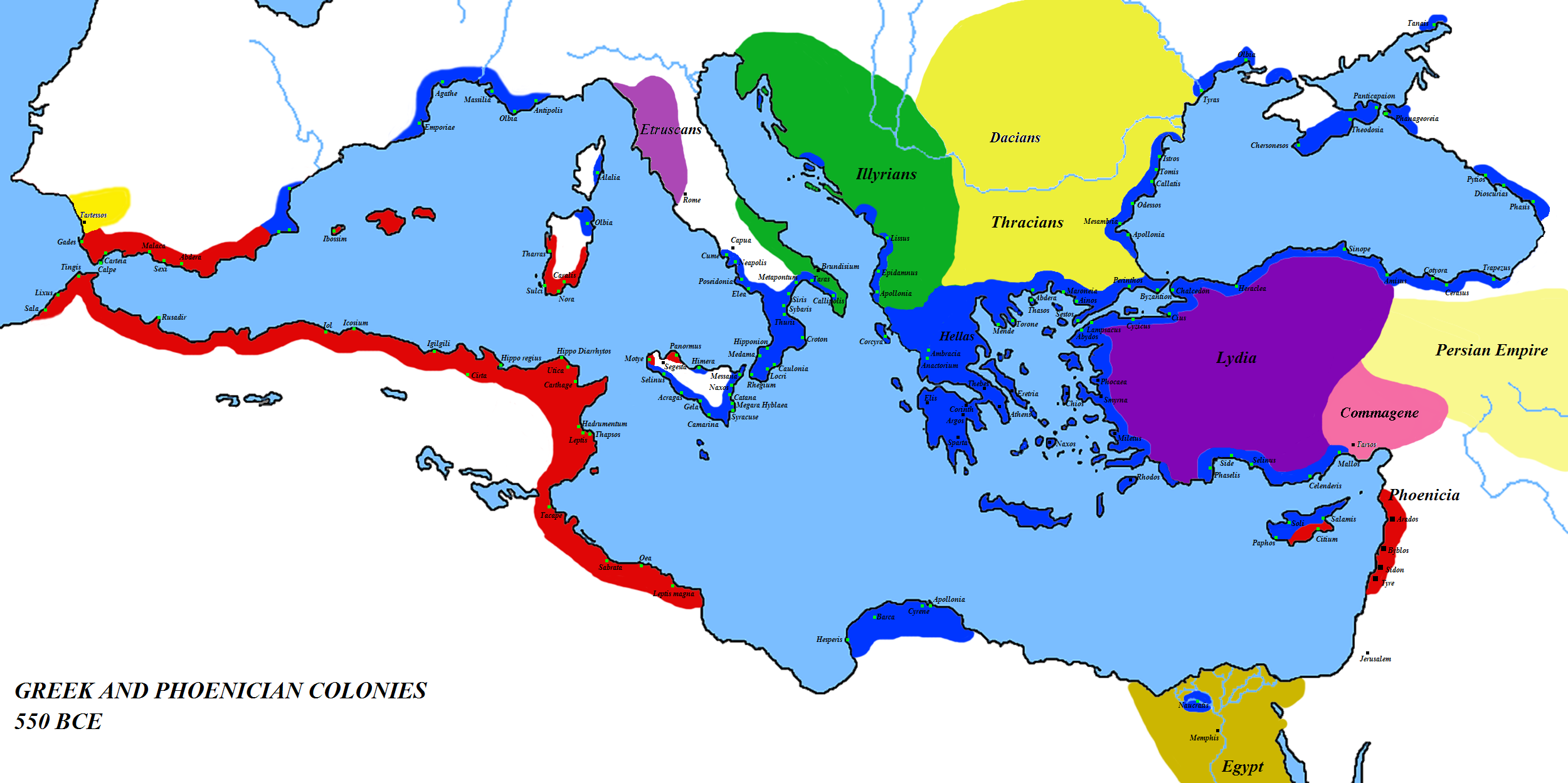
English: Map of the colonies of Ancient Greece and Phoenicia — circa 550 BCE.
|
| ⧼wm-license-information-date⧽ | قالب:Original upload date |
| ⧼wm-license-information-source⧽ | ⧼Wm-license-own-work⧽ (قالب:Original text) |
| ⧼wm-license-information-author⧽ | Javierfv1212 (talk) |
| ⧼wm-license-information-other-versions⧽ |
ترخيص
قالب:Original upload log
قالب:Transferred from قالب:Original description page
- 2008-03-08 15:09 Megistias 2500×1249× (768071 bytes) == Summary == {{Information |Description=Greek and Phoenecian colonies about 550 bc |Source=self-made |Date= |Location= |Author=[[User:Javierfv1212|Javierfv1212]] ([[User talk:Javierfv1212|talk]]),Modified by [[User:Megistias]] in the illyrian,thracian,gr
- 2008-03-01 03:09 Javierfv1212 2500×1249× (819010 bytes) {{Information |Description=Greek and Phoenecian colonies about 550 bc |Source=self-made |Date= |Location= |Author=~~~ |other_versions= }}
تاريخ الملف
اضغط على زمن/تاريخ لرؤية الملف كما بدا في هذا الزمن.
| زمن/تاريخ | صورة مصغرة | الأبعاد | مستخدم | تعليق | |
|---|---|---|---|---|---|
| حالي | ★ مراجعة معتمدة 13:39، 29 أكتوبر 2023 | | 2٬500 × 1٬249 (761 كيلوبايت) | Pastakhov (نقاش | مساهمات) | Upload https://upload.wikimedia.org/wikipedia/commons/d/dc/Ancient_colonies.PNG |
لا يمكنك استبدال هذا الملف.
وصلات
الصفحات التالية تحتوي على وصلة لهذه الصورة:
معلومات الصورة (ميتا)
تصنيفات:
- Former colonies
- Maps of the Greek colonies
- Maps of Phoenicia
- 550s BC
- Maps of the European Antiquity
- Maps of the ancient Near East
- Maps of the history of North Africa
- Maps of the Mediterranean Basin
- Maps of former countries
- Maps of international relations
- Political history maps
- Maps of Phoenician colonies
- Regions of ancient Greece