ملف:Alsmicke.jpg

حجم هذه المعاينة: 337 × 599 بكسل. البعدان الآخران: 1٬152 × 2٬048 بكسل | 2٬988 × 5٬312 بكسل.
الملف الأصلي (2٬988 × 5٬312 بكسل حجم الملف: 5٫99 ميجابايت، نوع MIME: image/jpeg)
وصف قصير
| ⧼wm-license-information-description⧽ |
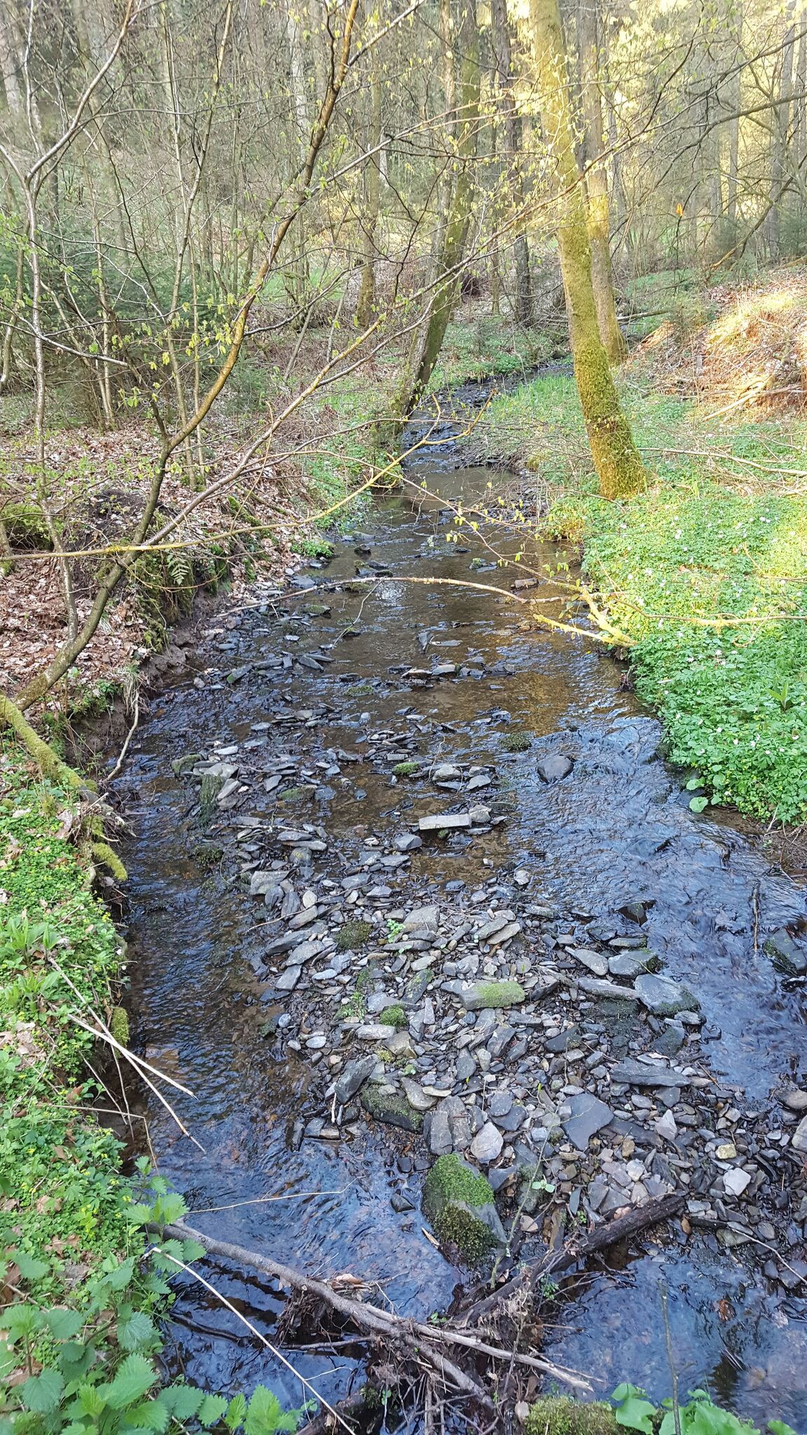
Deutsch: Die Alsmicke im Naturschutzgebiet „Alsmicketal mit Hangwäldern“ (NSG OE-061), in westlicher Richtung ca. 300 m oberhalb der Mündung
English: The brook Alsmicke a few hundred meters up its mouth, located in "Alsmicketal mit Hangwäldern" nature reserve (Germany).
|
| ⧼wm-license-information-date⧽ | 2017, {{time}} – invalid date format 39 (help) |
| ⧼wm-license-information-source⧽ | ⧼Wm-license-own-work⧽ |
| ⧼wm-license-information-author⧽ | Thariama |
51°02′54″N 7°49′41″E / 51.048227°N 7.827944°E
ترخيص
|
تاريخ الملف
اضغط على زمن/تاريخ لرؤية الملف كما بدا في هذا الزمن.
| زمن/تاريخ | صورة مصغرة | الأبعاد | مستخدم | تعليق | |
|---|---|---|---|---|---|
| حالي | ★ مراجعة معتمدة 18:32، 25 أكتوبر 2023 | | 2٬988 × 5٬312 (5٫99 ميجابايت) | Pastakhov (نقاش | مساهمات) | Upload https://upload.wikimedia.org/wikipedia/commons/4/42/Alsmicke.jpg |
لا يمكنك استبدال هذا الملف.
وصلات
لا يوجد صفحات تصل لهذه الصورة.