ملف:All Saints Church - geograph.org.uk - 1349914.jpg
حجم هذه المعاينة: 450 × 600 بكسل. البعد الآخر: 480 × 640 بكسل.
الملف الأصلي (480 × 640 بكسل حجم الملف: 106 كيلوبايت، نوع MIME: image/jpeg)
وصف قصير
| ⧼wm-license-information-description⧽ |
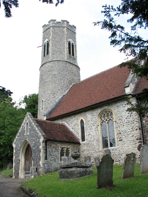
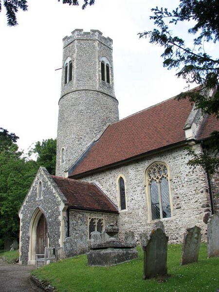
English: All Saints Church. All Saints church is located on the edge of Intwood Hall > 1349893 and park, where Intwood Road changes its name to Intwood Lane. It is believed that some of the masonry of the nearby All Saints church > 1348129 in Keswick was used for restoring Intwood church in the late 16th century. The round tower has a C15 octagonal top and as a whole this church is difficult to photograph because it is surrounded by tall trees on all sides. Concerning the interior - the building is kept locked, the keyholder was out and another visit is on the agenda.
|
| ⧼wm-license-information-date⧽ | 2009 |
| ⧼wm-license-information-source⧽ | From geograph.org.uk |
| ⧼wm-license-information-author⧽ | Evelyn Simak |
| ⧼wm-license-cc-attribution⧽ (قالب:I18n/Credit line) |
Evelyn Simak / All Saints Church / |
52°35′26″N 1°14′32″E / 52.59067°N 1.2421°E قالب:Object location
_heading:315)
ترخيص
تاريخ الملف
اضغط على زمن/تاريخ لرؤية الملف كما بدا في هذا الزمن.
| زمن/تاريخ | صورة مصغرة | الأبعاد | مستخدم | تعليق | |
|---|---|---|---|---|---|
| حالي | ★ مراجعة معتمدة 15:59، 13 ديسمبر 2023 | | 480 × 640 (106 كيلوبايت) | Pastakhov (نقاش | مساهمات) | Upload https://upload.wikimedia.org/wikipedia/commons/5/58/All_Saints_Church_-_geograph.org.uk_-_1349914.jpg |
لا يمكنك استبدال هذا الملف.
وصلات
لا يوجد صفحات تصل لهذه الصورة.