ملف:Alcalá de Henares (RPS 13-04-2019) vía pecuaria, cartel.png

حجم هذه المعاينة: 423 × 599 بكسل. البعد الآخر: 2٬069 × 2٬931 بكسل.
الملف الأصلي (2٬069 × 2٬931 بكسل حجم الملف: 6٫8 ميجابايت، نوع MIME: image/png)
وصف قصير
| ⧼wm-license-information-description⧽ |
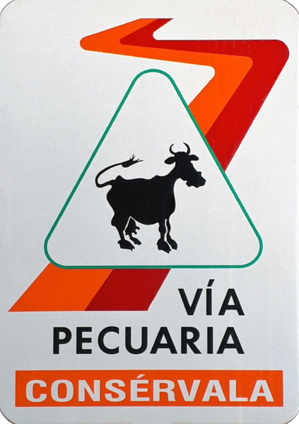
Español: Cartel indicando una قالب:We en Alcalá de Henares (Comunidad de Madrid - España). Está situado en el "Cordel de Talamanca", con una longitud de 4,95 km, y el código nº 2800511 como vía pecuaria de la Comunidad de Madrid.[1]
|
| ⧼wm-license-information-date⧽ | 2019 |
| ⧼wm-license-information-source⧽ | ⧼Wm-license-own-work⧽ |
| ⧼wm-license-information-author⧽ | Raimundo Pastor |
| ⧼wm-license-information-permission⧽ (⧼wm-license-information-permission-reusing-text⧽) |
40°29′57″N 3°22′50″W / 40.499056°N 3.380539°W
_v%C3%ADa_pecuaria,_cartel.png¶ms=40.499056_N_3.380539_W_)
ترخيص
|
Referencias
تاريخ الملف
اضغط على زمن/تاريخ لرؤية الملف كما بدا في هذا الزمن.
| زمن/تاريخ | صورة مصغرة | الأبعاد | مستخدم | تعليق | |
|---|---|---|---|---|---|
| حالي | ★ مراجعة معتمدة 06:37، 7 ديسمبر 2023 | | 2٬069 × 2٬931 (6٫8 ميجابايت) | Pastakhov (نقاش | مساهمات) | Upload https://upload.wikimedia.org/wikipedia/commons/6/6c/Alcal%C3%A1_de_Henares_%28RPS_13-04-2019%29_v%C3%ADa_pecuaria%2C_cartel.png |
لا يمكنك استبدال هذا الملف.
وصلات
لا يوجد صفحات تصل لهذه الصورة.
معلومات الصورة (ميتا)
_vía_pecuaria,_cartel.png&oldid=3710275)
تصنيفات:
- Self-published work
- Rutas por Alcalá de Henares
- Cultural street signs in Alcalá de Henares
- Artistic street signs in Alcalá de Henares
- 2019 in Alcalá de Henares
- Pedestrian-related regulatory road signs in Spain
- Spanish-language signs in Spain
- Green, orange, red signs
- Posters in Alcalá de Henares
- Spanish-language posters
- Posters of Spain, 2019
- Rectangular plaques in Spain
- Metal plaques in Spain
- Illustrations with cows
- Cows in art of Spain
- Spanish-language logos
- Colorful logos
- Logos of the Community of Madrid
- Cows in logos
- FoP-Spain
- Taken with SM-A520F
- Spain photographs taken on 2019-04-13
- Files by User:Raimundo Pastor
- Vía pecuaria signs
- Imperative mood in Spanish language
- PNG photos
- PNG diagrams