ملف:Aingoulaincourt photo drone du village.jpg
حجم هذه المعاينة: 800 × 453 بكسل. البعد الآخر: 1٬920 × 1٬088 بكسل.
الملف الأصلي (1٬920 × 1٬088 بكسل حجم الملف: 354 كيلوبايت، نوع MIME: image/jpeg)
وصف قصير
| ⧼wm-license-information-description⧽ |
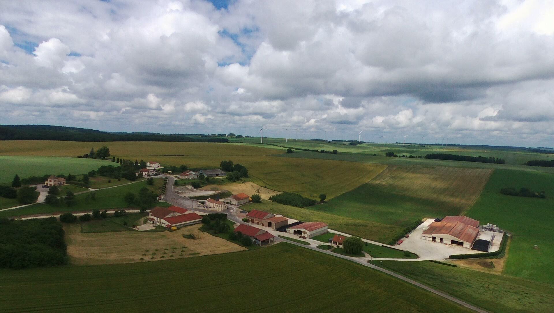
English: Photo relative à la commune d’Aingoulaincourt dans le but d’enrichir la page Wikipedia existante, il y a la photo d’Aingoulaincourt , et de son Église ( aussi intérieur)
|
| ⧼wm-license-information-date⧽ | 2018, {{time}} – invalid date format 45 (help) |
| ⧼wm-license-information-source⧽ | ⧼Wm-license-own-work⧽ |
| ⧼wm-license-information-author⧽ | Paularchambaux |
48°27′18″N 5°17′28″E / 48.454889°N 5.2912°E
ترخيص
|
تاريخ الملف
اضغط على زمن/تاريخ لرؤية الملف كما بدا في هذا الزمن.
| زمن/تاريخ | صورة مصغرة | الأبعاد | مستخدم | تعليق | |
|---|---|---|---|---|---|
| حالي | ★ مراجعة معتمدة 16:34، 1 نوفمبر 2023 | | 1٬920 × 1٬088 (354 كيلوبايت) | Pastakhov (نقاش | مساهمات) | Upload https://upload.wikimedia.org/wikipedia/commons/c/ca/Aingoulaincourt_photo_drone_du_village.jpg |
لا يمكنك استبدال هذا الملف.
وصلات
لا يوجد صفحات تصل لهذه الصورة.