ملف:AgrigentoMap.png
AgrigentoMap.png (234 × 229 بكسل حجم الملف: 14 كيلوبايت، نوع MIME: image/png)
وصف قصير
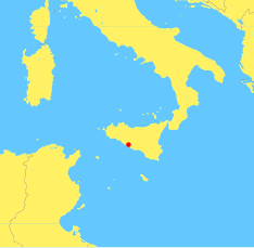
Map of central Mediterranean, showing location of Agrigento (ancient Agrigentum or Akragas), 37.31 N, 13.58 E
This image is an original work by Robert Dodier (User:Wile E. Heresiarch).

|
Created by GMT (Generic Mapping Tools, http://gmt.soest.hawaii.edu Archive copy at the Internet Archive ), an open source cartographic software, using the map data that comes packaged with GMT. The map data were derived by the authors of GMT from two public domain databases. See Appendix K of The Generic Mapping Tools Version 3.4.4 Technical Reference and Cookbook Archive copy at the Internet Archive.
Commands to create this map:
$ pscoast -Jm0.25i -R7/20/33/43 -G255/240/100 -S100/200/255 -P -V -W1/255/255/120 -N1/1/150/150/150  -Dh -K > agrigento_location.ps
$ psxy -Jm0.25i -R7/20/33/43 -Sc0.15  -G255/0/0 -V -P -O >> agrigento_location.ps
$ ps2epsi agrigento_location.ps
$ mogrify -format png agrigento_location.epsi
pscoast and psxy are from GMT. mogrify is from ImageMagick. ps2epsi is invoked solely to trim the bounding box down to just the size of the map image.
Map of central Mediterranean, showing location of Agrigento (ancient Agrigentum or Akragas), 37.31 N, 13.58 E
This image is an original work by Robert Dodier (User:Wile E. Heresiarch).
|
|
Created by GMT (Generic Mapping Tools, http://gmt.soest.hawaii.edu Archive copy at the Internet Archive ), an open source cartographic software, using the map data that comes packaged with GMT. The map data were derived by the authors of GMT from two public domain databases. See Appendix K of The Generic Mapping Tools Version 3.4.4 Technical Reference and Cookbook Archive copy at the Internet Archive.
Commands to create this map:
$ pscoast -Jm0.25i -R7/20/33/43 -G255/240/100 -S100/200/255 -P -V -W1/255/255/120 -N1/1/150/150/150  -Dh -K > agrigento_location.ps
$ psxy -Jm0.25i -R7/20/33/43 -Sc0.15  -G255/0/0 -V -P -O >> agrigento_location.ps
$ ps2epsi agrigento_location.ps
$ mogrify -format png agrigento_location.epsi
pscoast and psxy are from GMT. mogrify is from ImageMagick. ps2epsi is invoked solely to trim the bounding box down to just the size of the map image.
ترخيص
|
|
تاريخ الملف
اضغط على زمن/تاريخ لرؤية الملف كما بدا في هذا الزمن.
| زمن/تاريخ | صورة مصغرة | الأبعاد | مستخدم | تعليق | |
|---|---|---|---|---|---|
| حالي | ★ مراجعة معتمدة 10:44، 18 نوفمبر 2023 | | 234 × 229 (14 كيلوبايت) | Pastakhov (نقاش | مساهمات) | Upload https://upload.wikimedia.org/wikipedia/commons/0/0b/AgrigentoMap.png |
لا يمكنك استبدال هذا الملف.
وصلات
لا يوجد صفحات تصل لهذه الصورة.