ملف:Aerial view of SEEVIC, Benfleet - geograph.org.uk - 1574012.jpg
لا توجد دقة أعلى متوفرة.
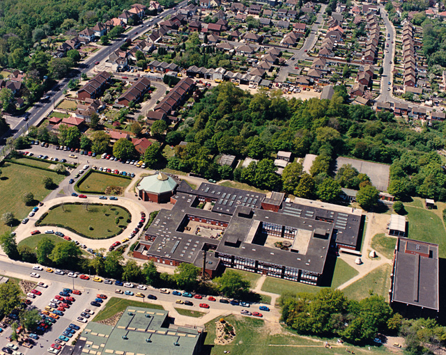
Aerial_view_of_SEEVIC,_Benfleet_-_geograph.org.uk_-_1574012.jpg (640 × 510 بكسل حجم الملف: 314 كيلوبايت، نوع MIME: image/jpeg)
وصف قصير
| ⧼wm-license-information-description⧽ |
English: Aerial view of SEEVIC, Benfleet. At the time of this photo, in 1987, this was known as South-East Essex Sixth-form College, and given the acronym SEEVIC (VI for six). Today it has lost the sixth-form connotation, and bears the name of SEEVIC College. (See 746857 for an modern view.) The circular building at the upper left of the college is a theatre widely used for public events, as well as teaching. The road to the top left is the A13 (London Road). The building at the bottom is Runnymede Pool.
|
| ⧼wm-license-information-date⧽ | 1987 |
| ⧼wm-license-information-source⧽ | From geograph.org.uk |
| ⧼wm-license-information-author⧽ | Edward Clack |
| ⧼wm-license-cc-attribution⧽ (قالب:I18n/Credit line) |
Edward Clack / Aerial view of SEEVIC, Benfleet / |
51°33′46″N 0°35′21″E / 51.56287°N 0.5892°E قالب:Object location
_heading:270)
ترخيص
تاريخ الملف
اضغط على زمن/تاريخ لرؤية الملف كما بدا في هذا الزمن.
| زمن/تاريخ | صورة مصغرة | الأبعاد | مستخدم | تعليق | |
|---|---|---|---|---|---|
| حالي | ★ مراجعة معتمدة 21:17، 10 أكتوبر 2023 | | 640 × 510 (314 كيلوبايت) | Pastakhov (نقاش | مساهمات) | Upload https://upload.wikimedia.org/wikipedia/commons/8/87/Aerial_view_of_SEEVIC%2C_Benfleet_-_geograph.org.uk_-_1574012.jpg |
لا يمكنك استبدال هذا الملف.
وصلات
لا يوجد صفحات تصل لهذه الصورة.