ملف:Aerial image of Orangery Palace (view from the south).jpg

حجم هذه المعاينة: 800 × 443 بكسل. البعدان الآخران: 2٬560 × 1٬416 بكسل | 4٬700 × 2٬600 بكسل.
الملف الأصلي (4٬700 × 2٬600 بكسل حجم الملف: 6٫88 ميجابايت، نوع MIME: image/jpeg)
وصف قصير
| ⧼wm-license-information-description⧽ |
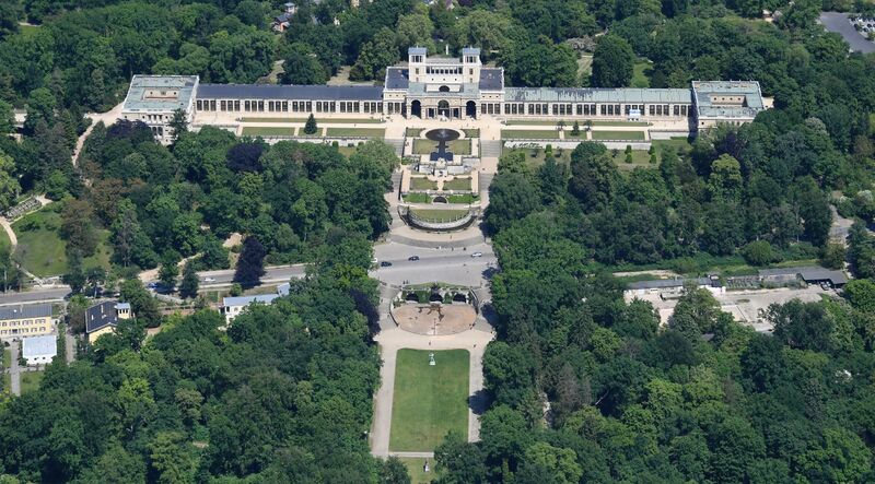
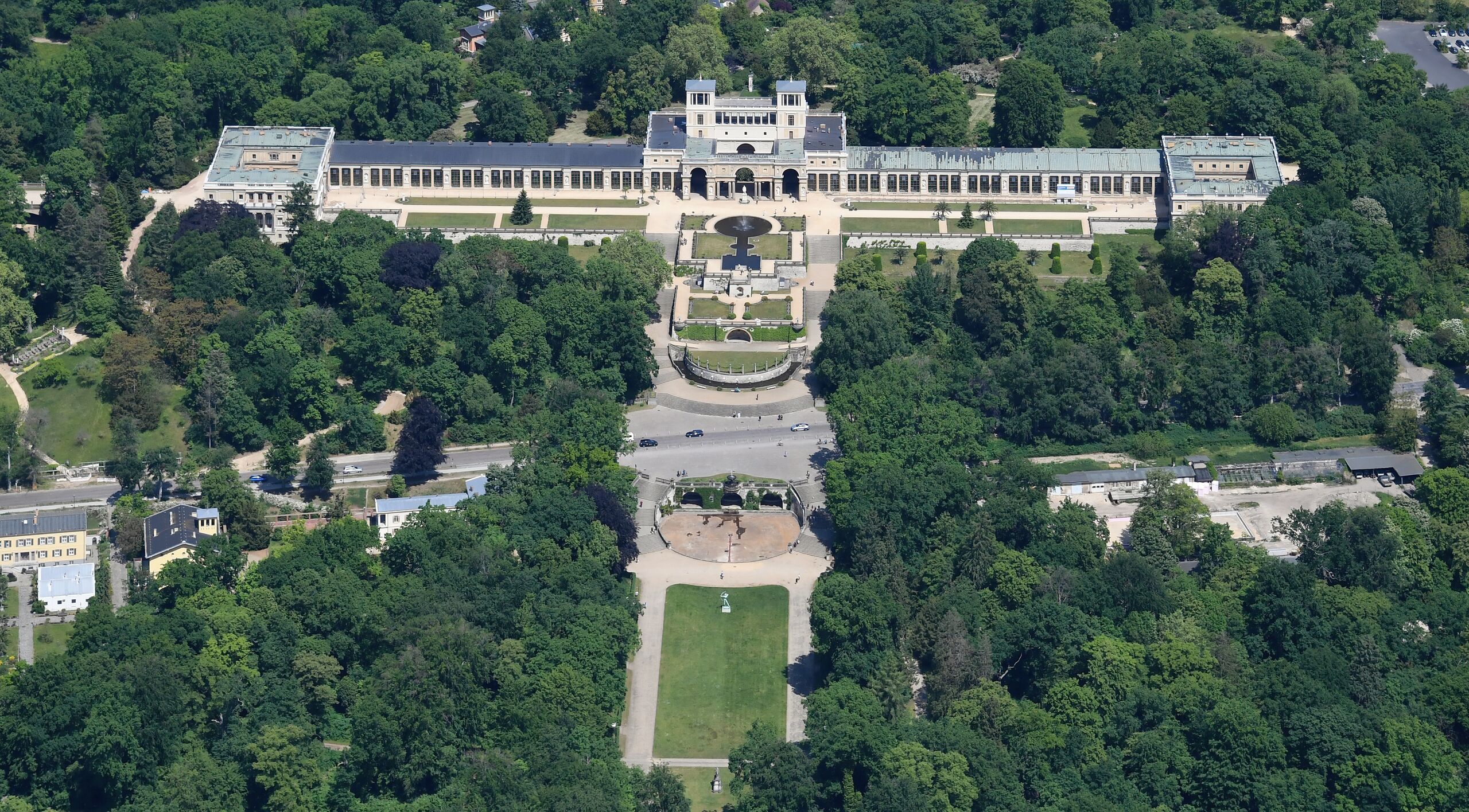
English: Aerial image of Orangery Palace (view from the south)
Deutsch: Luftbild des Orangerieschloss (Ansicht von Süden) قالب:Baudenkmal Brandenburg
|
| ⧼wm-license-information-date⧽ | 2023, {{time}} – invalid date format 52 (help) |
| ⧼wm-license-information-source⧽ | ⧼Wm-license-own-work⧽ |
| ⧼wm-license-information-author⧽ | Carsten Steger |
52°23′37″N 13°01′26″E / 52.393611°N 13.023889°E قالب:Object location قالب:World Heritage Site
.jpg¶ms=52.393611_N_13.023889_E_heading:15)
ترخيص
|
تاريخ الملف
اضغط على زمن/تاريخ لرؤية الملف كما بدا في هذا الزمن.
| زمن/تاريخ | صورة مصغرة | الأبعاد | مستخدم | تعليق | |
|---|---|---|---|---|---|
| حالي | ★ مراجعة معتمدة 21:06، 8 نوفمبر 2023 | | 4٬700 × 2٬600 (6٫88 ميجابايت) | Pastakhov (نقاش | مساهمات) | Upload https://upload.wikimedia.org/wikipedia/commons/3/3f/Aerial_image_of_Orangery_Palace_%28view_from_the_south%29.jpg |
لا يمكنك استبدال هذا الملف.
وصلات
لا يوجد صفحات تصل لهذه الصورة.
.jpg&oldid=3414865)