ملف:Abbey Wood, The Harrow Inn - geograph.org.uk - 382725.jpg
لا توجد دقة أعلى متوفرة.
Abbey_Wood,_The_Harrow_Inn_-_geograph.org.uk_-_382725.jpg (640 × 480 بكسل حجم الملف: 86 كيلوبايت، نوع MIME: image/jpeg)
وصف قصير
| ⧼wm-license-information-description⧽ |
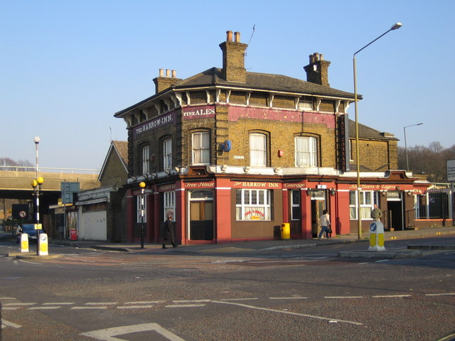
English: Abbey Wood: The Harrow Inn This public house is mentioned in a description of the hamlet of Abbey Wood in the late 1860s when it was one of the very few buildings. It is at the junction of Abbey Wood Road with Wilton Road. The A2041 Harrow Manorway flyover across the railway can be seen in the distance on the left. Various on-line pub guides describe the clientele of the pub as "local". Demolished in 2009 and now a derelict site.
|
| ⧼wm-license-information-date⧽ | 2007 |
| ⧼wm-license-information-source⧽ | From geograph.org.uk |
| ⧼wm-license-information-author⧽ | Nigel Cox |
| ⧼wm-license-cc-attribution⧽ (قالب:I18n/Credit line) |
Nigel Cox / Abbey Wood: The Harrow Inn / |
51°29′22″N 0°07′16″E / 51.4894°N 0.121°E قالب:Object location
_heading:112)
ترخيص
تاريخ الملف
اضغط على زمن/تاريخ لرؤية الملف كما بدا في هذا الزمن.
| زمن/تاريخ | صورة مصغرة | الأبعاد | مستخدم | تعليق | |
|---|---|---|---|---|---|
| حالي | ★ مراجعة معتمدة 03:42، 18 أكتوبر 2023 | | 640 × 480 (86 كيلوبايت) | Pastakhov (نقاش | مساهمات) | Upload https://upload.wikimedia.org/wikipedia/commons/0/05/Abbey_Wood%2C_The_Harrow_Inn_-_geograph.org.uk_-_382725.jpg |
لا يمكنك استبدال هذا الملف.
وصلات
لا يوجد صفحات تصل لهذه الصورة.