ملف:7.5 minute series orthophotomap (topographic).jpg
حجم هذه المعاينة: 504 × 600 بكسل. البعدان الآخران: 1٬722 × 2٬048 بكسل | 3٬783 × 4٬500 بكسل.
الملف الأصلي (3٬783 × 4٬500 بكسل حجم الملف: 3٫38 ميجابايت، نوع MIME: image/jpeg)
وصف قصير
| ⧼wm-license-information-description⧽ |
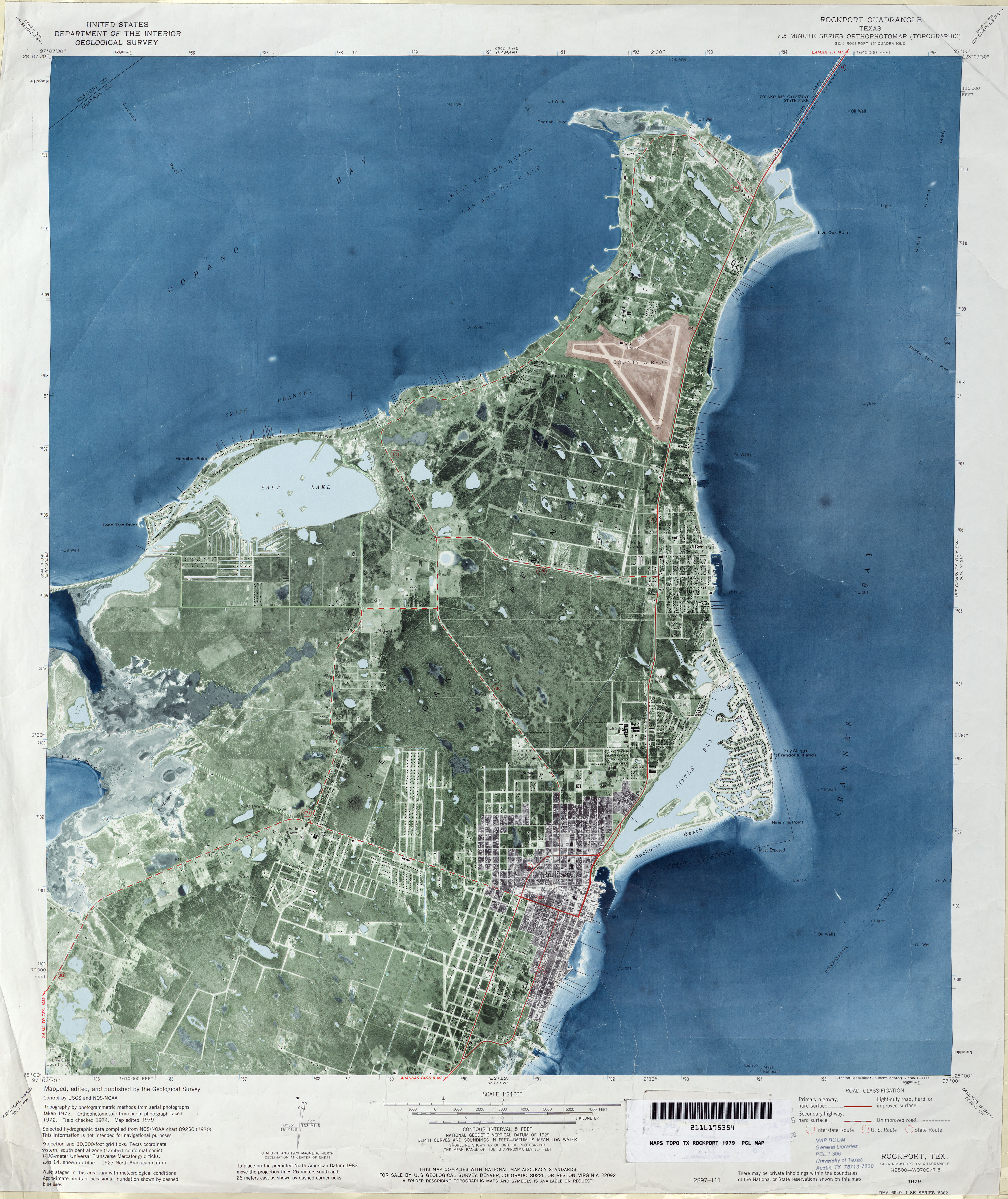
Català: Ortofotomapa del quadrangle de Rockport, Texas, EEUU. Editat el 1974 pel US Geological Survey a partir d'un ortofotomosaic de fotografies preses el 1972.
English: Rockport, Texas, 7.5 Minute Series Orthophotomap
|
| ⧼wm-license-information-date⧽ | aerial photographs taken 1972, map edited 1979, printed 1983 |
| ⧼wm-license-information-source⧽ | http://www.lib.utexas.edu/maps/ |
| ⧼wm-license-information-author⧽ | U.S. Geological Survey |
ترخيص
تاريخ الملف
اضغط على زمن/تاريخ لرؤية الملف كما بدا في هذا الزمن.
| زمن/تاريخ | صورة مصغرة | الأبعاد | مستخدم | تعليق | |
|---|---|---|---|---|---|
| حالي | ★ مراجعة معتمدة 14:47، 13 أكتوبر 2023 | | 3٬783 × 4٬500 (3٫38 ميجابايت) | Pastakhov (نقاش | مساهمات) | Upload https://upload.wikimedia.org/wikipedia/commons/6/63/7.5_minute_series_orthophotomap_%28topographic%29.jpg |
لا يمكنك استبدال هذا الملف.
وصلات
لا يوجد صفحات تصل لهذه الصورة.
.jpg&oldid=3098163)