ملف:14th Street Bridge 1932.jpg
الملف الأصلي (3٬664 × 2٬676 بكسل حجم الملف: 828 كيلوبايت، نوع MIME: image/jpeg)
| ⧼wm-license-information-description⧽ |
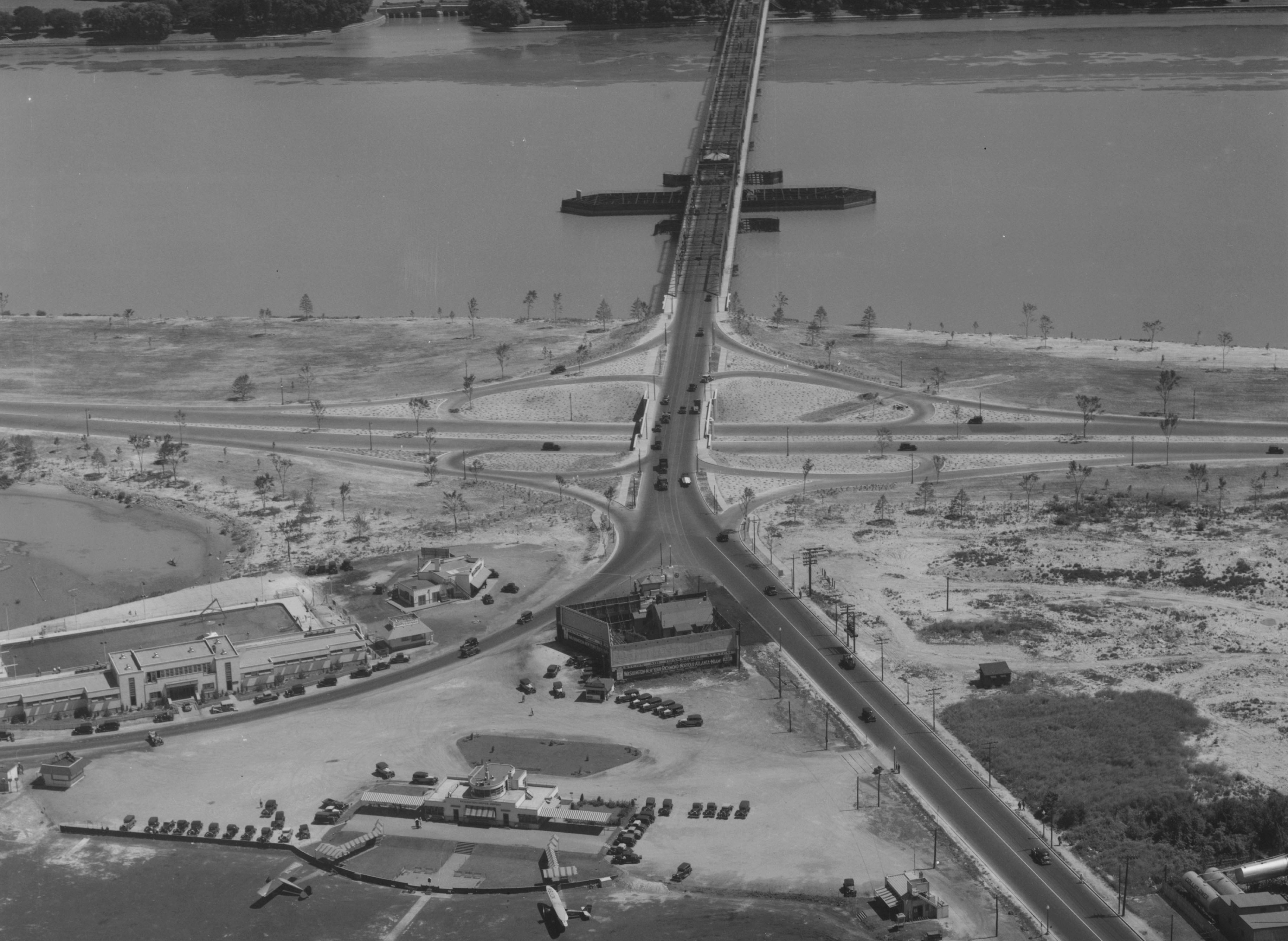
This is a crop of a 1932 photo of the Long Bridge (now the 14th Street Bridge) over the Potomac River, looking from Virginia towards the District of Columbia. And the bottom left of the photo is Hoover Field, a major airport serving the city of Washington, D.C. The road (bottom, curving right) is Military Road. At the bottom right is the northern end of Washington Airport, another major airport serving the city. The image is part of the U.S. Bureau of Public Roads Photographs collection from the National Archives, reproduced as part of the Historic American Engineering Record. |
| ⧼wm-license-information-date⧽ | 1932 |
| ⧼wm-license-information-source⧽ | قالب:LOC-image |
| ⧼wm-license-information-author⧽ | Historic American Engineering Record |
| ⧼wm-license-information-permission⧽ (⧼wm-license-information-permission-reusing-text⧽) |
تاريخ الملف
اضغط على زمن/تاريخ لرؤية الملف كما بدا في هذا الزمن.
| زمن/تاريخ | صورة مصغرة | الأبعاد | مستخدم | تعليق | |
|---|---|---|---|---|---|
| حالي | ★ مراجعة معتمدة 00:13، 23 يناير 2024 | | 3٬664 × 2٬676 (828 كيلوبايت) | Pastakhov (نقاش | مساهمات) | Upload https://upload.wikimedia.org/wikipedia/commons/2/29/14th_Street_Bridge_1932.jpg |
لا يمكنك استبدال هذا الملف.
وصلات
لا يوجد صفحات تصل لهذه الصورة.
معلومات الصورة (ميتا)
- Long Bridge
- Fort Runyon
- Former airports in Washington, D.C.
- Swing bridges in Virginia
- Swing bridges in Washington, D.C.
- 1932 in Virginia
- Interchanges in Virginia
- Aerial photographs of interchanges in the United States
- Aerial photographs of Virginia
- Aerial photographs of Washington, D.C.
- 1932 in Washington, D.C.