ملف:140427-1988 Linwood (14118303383).jpg
حجم هذه المعاينة: 800 × 534 بكسل. البعدان الآخران: 2٬560 × 1٬709 بكسل | 5٬520 × 3٬684 بكسل.
الملف الأصلي (5٬520 × 3٬684 بكسل حجم الملف: 6٫24 ميجابايت، نوع MIME: image/jpeg)
وصف قصير
| ⧼wm-license-information-description⧽ |
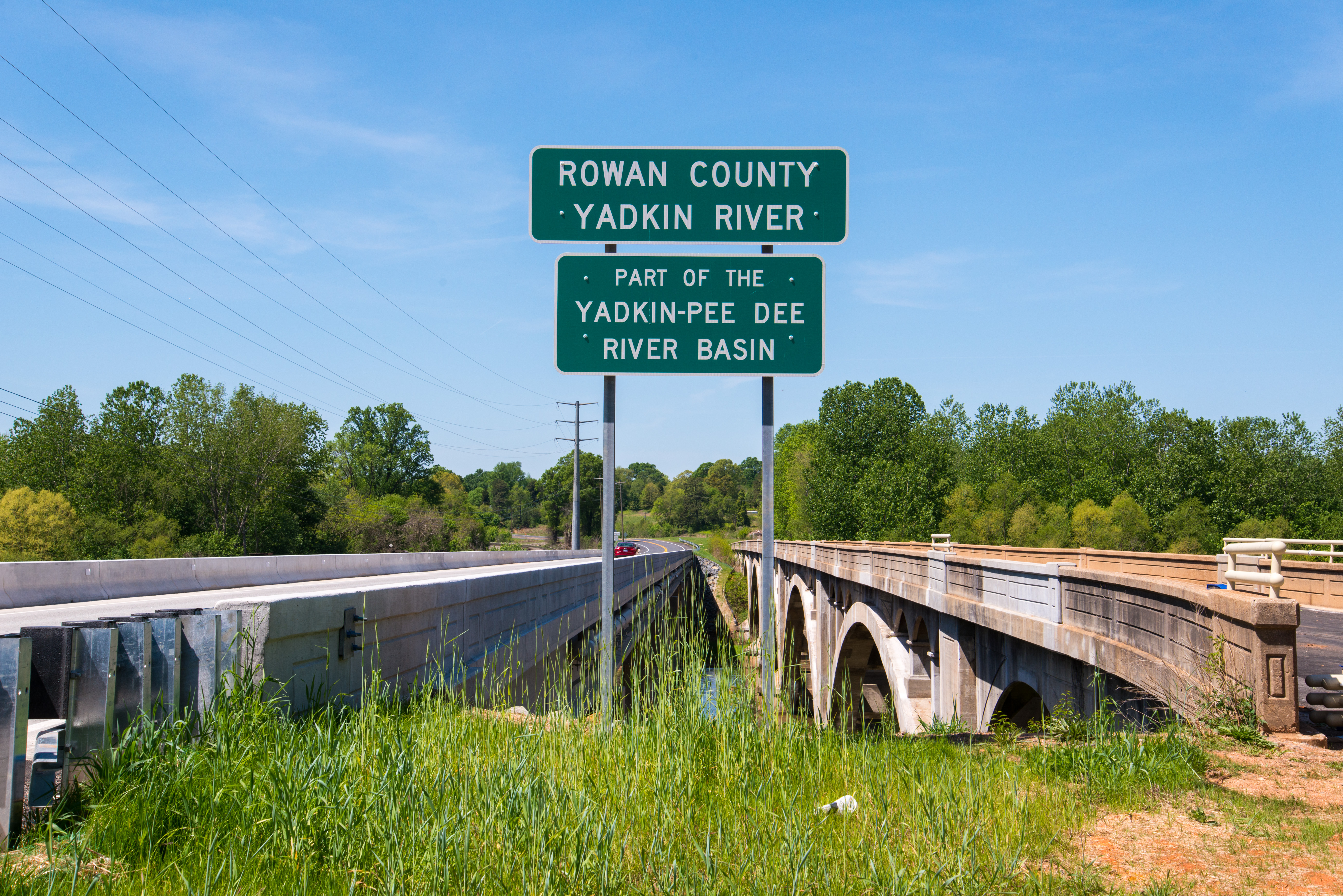
English: At center is a sign identifying the Yadkin River and the county across the banks. On the left is a newly constructed bridge that replaced a 1951 bridge; which was originally served as a companion bridge, providing two lanes of northbound traffic. On the right is the Wil-Cox bridge, which has existed since 1924 as a two-lane bridge (and then solely southbound traffic after 1951); in late 2013, it saved by Davidson county and is now a pedestrian only bridge.
|
| ⧼wm-license-information-date⧽ | 2014, {{time}} – invalid date format 51 (help) |
| ⧼wm-license-information-source⧽ | https://www.flickr.com/photos/washuotaku/14118303383/ |
| ⧼wm-license-information-author⧽ | Mark Clifton |
35°43′23″N 80°23′26″W / 35.722963°N 80.390417°W
.jpg¶ms=35.722963_N_80.390417_W_)
ترخيص
تاريخ الملف
اضغط على زمن/تاريخ لرؤية الملف كما بدا في هذا الزمن.
| زمن/تاريخ | صورة مصغرة | الأبعاد | مستخدم | تعليق | |
|---|---|---|---|---|---|
| حالي | ★ مراجعة معتمدة 08:02، 14 أكتوبر 2023 | | 5٬520 × 3٬684 (6٫24 ميجابايت) | Pastakhov (نقاش | مساهمات) | Upload https://upload.wikimedia.org/wikipedia/commons/0/0f/140427-1988_Linwood_%2814118303383%29.jpg |
لا يمكنك استبدال هذا الملف.
وصلات
لا يوجد صفحات تصل لهذه الصورة.
.jpg&oldid=3113739)