ملف:0 5371 Engelberg - Brunni.jpg

حجم هذه المعاينة: 800 × 533 بكسل. البعدان الآخران: 2٬560 × 1٬707 بكسل | 5٬700 × 3٬800 بكسل.
الملف الأصلي (5٬700 × 3٬800 بكسل حجم الملف: 16٫51 ميجابايت، نوع MIME: image/jpeg)
وصف قصير
| ⧼wm-license-information-description⧽ |
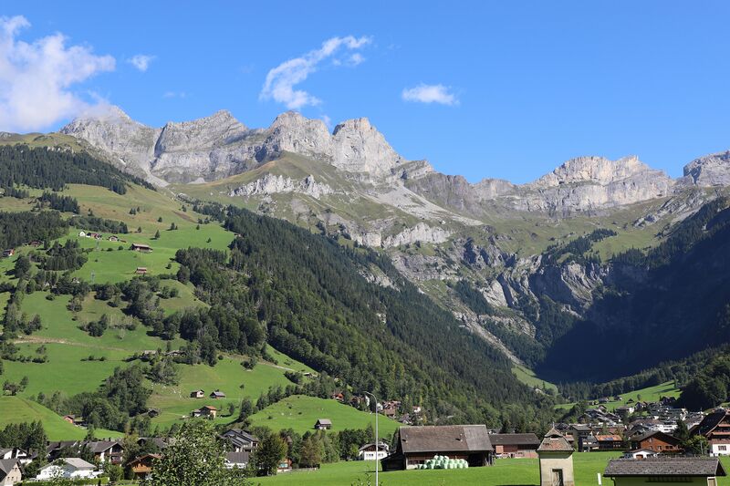
Deutsch: Engelberg im Kanton Obwalden (Schweiz). Links im Bild Brunni (Wandergebiet), die Berggipfel Rigidalstock (2.593 Meter ü. M.), Gross Sättelistock (2.637 Meter ü. M.), den Planggengrat und den Laucherenstock (2.639 Meter ü. M.) sowie unten rechts im Bild den Weiler Horbis im Talkessel „Ende der Welt“.
English: Engelberg in the canton of Obwalden (Switzerland). On the left in the picture Brunni (hiking area), the mountain peaks Rigidalstock (2,593 meters above sea level), Gross Sättelistock (2,637 meters above sea level), the Planggengrat and the Laucherenstock (2,639 meters above sea level) and the hamlet of Horbis im “End of the world” basin.
|
| ⧼wm-license-information-date⧽ | 2021, {{time}} – invalid date format 18 (help) |
| ⧼wm-license-information-source⧽ | ⧼Wm-license-own-work⧽ |
| ⧼wm-license-information-author⧽ | W. Bulach |
46°48′51″N 8°24′56″E / 46.814098°N 8.415613°E
ترخيص
|
تاريخ الملف
اضغط على زمن/تاريخ لرؤية الملف كما بدا في هذا الزمن.
| زمن/تاريخ | صورة مصغرة | الأبعاد | مستخدم | تعليق | |
|---|---|---|---|---|---|
| حالي | ★ مراجعة معتمدة 09:19، 9 نوفمبر 2023 | | 5٬700 × 3٬800 (16٫51 ميجابايت) | Pastakhov (نقاش | مساهمات) | Upload https://upload.wikimedia.org/wikipedia/commons/8/80/0_5371_Engelberg_-_Brunni.jpg |
لا يمكنك استبدال هذا الملف.
وصلات
لا يوجد صفحات تصل لهذه الصورة.