ملف:0 3459 Südküste Chiles.jpg
حجم هذه المعاينة: 800 × 531 بكسل. البعد الآخر: 2٬499 × 1٬660 بكسل.
الملف الأصلي (2٬499 × 1٬660 بكسل حجم الملف: 2٫78 ميجابايت، نوع MIME: image/jpeg)
وصف قصير
| ⧼wm-license-information-description⧽ |
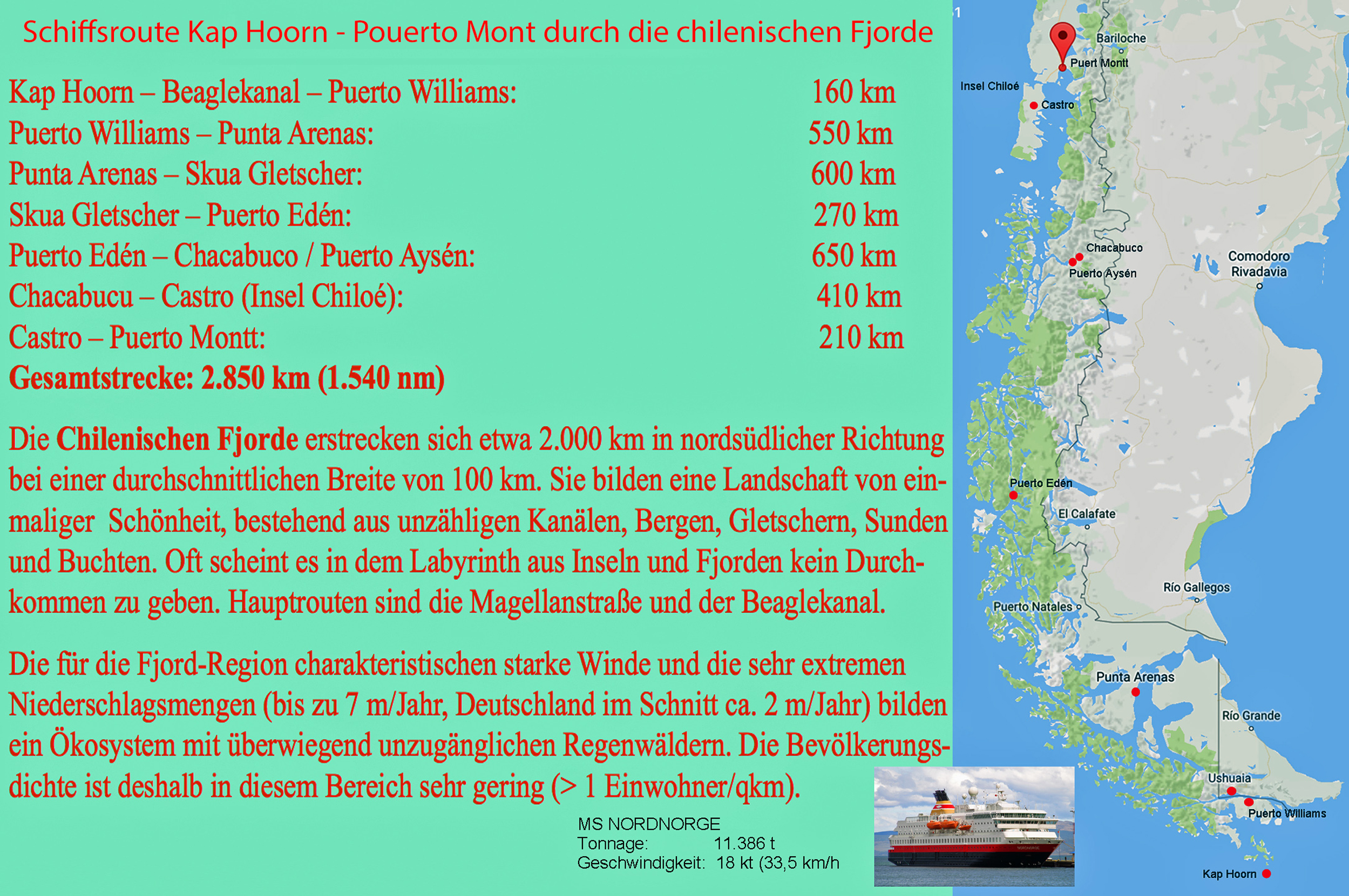
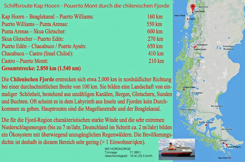
Deutsch: Die chilenische Küste im Bereich von Padagonien weist eine große Anzahl von schiffbaren Fjorden, Kanälen und Meerengen auf, die durchgehend Zugang zu Häfen wie Puerto Williams, Punto Arenas, Chacobuco und Puerto Mont bieten.
English: The Chilean coast in the Padagonian area features a large number of navigable fjords, channels and straits that provide continuous access to ports such as Puerto Williams, Punto Arenas, Chacobuco and Puerto Mont.
|
| ⧼wm-license-information-date⧽ | 2005, {{time}} – invalid date format 23 (help) |
| ⧼wm-license-information-source⧽ | Modifizierung der Karte OpenStreetMap |
| ⧼wm-license-information-author⧽ | Modifizierung der Karte OpenStreetMap |
ترخيص
|
|
هذا العمل مرخّص تحت رخصة المشاع الإبداعي الملزمة بنسبة العمل لمؤلفه وبترخيص الأعمال المشتقة بالمثل 4.0. |
تاريخ الملف
اضغط على زمن/تاريخ لرؤية الملف كما بدا في هذا الزمن.
| زمن/تاريخ | صورة مصغرة | الأبعاد | مستخدم | تعليق | |
|---|---|---|---|---|---|
| حالي | ★ مراجعة معتمدة 19:12، 19 أكتوبر 2023 | | 2٬499 × 1٬660 (2٫78 ميجابايت) | Pastakhov (نقاش | مساهمات) | Upload https://upload.wikimedia.org/wikipedia/commons/2/28/0_3459_S%C3%BCdk%C3%BCste_Chiles.jpg |
لا يمكنك استبدال هذا الملف.
وصلات
لا يوجد صفحات تصل لهذه الصورة.