ملف:00 1836 West Coastel Highway (National Route 1) - Tropic of Capricorn.jpg
حجم هذه المعاينة: 800 × 533 بكسل. البعدان الآخران: 2٬560 × 1٬707 بكسل | 4٬200 × 2٬800 بكسل.
الملف الأصلي (4٬200 × 2٬800 بكسل حجم الملف: 10٫32 ميجابايت، نوع MIME: image/jpeg)
وصف قصير
| ⧼wm-license-information-description⧽ |
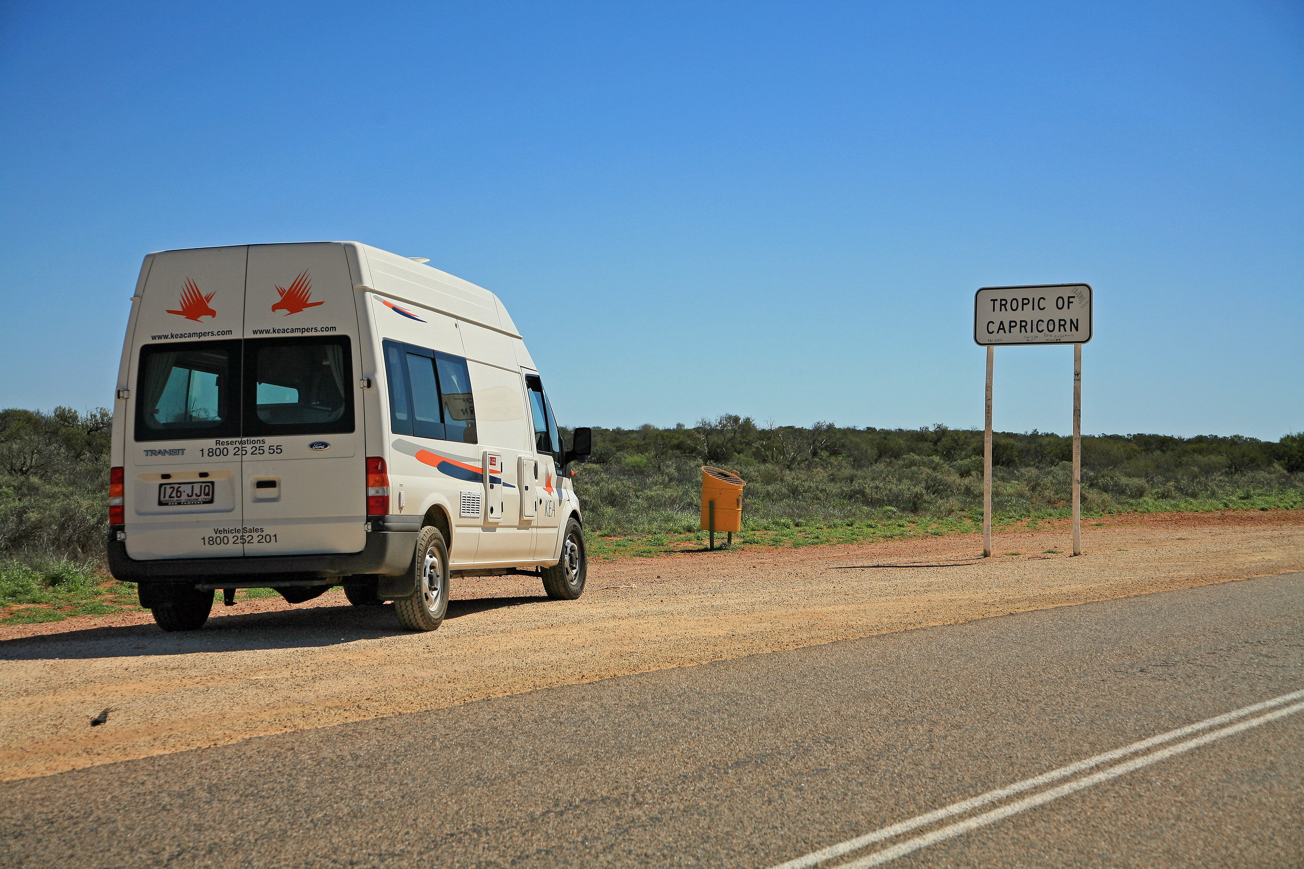
Deutsch: Südlicher Wendekreis (Breitenkreis 23 26` 5 südlich) am North West Coastel Highway (National Route 1). Bezeichnung nach dem Sternbild: Wendekreis des Steinbocks (engl. Tropic of Capricorn).
English: Southern Tropic (latitude 23 26`5 south) on the North West Coastel Highway (National Route 1). Name after the constellation: Tropic of Capricorn.
|
| ⧼wm-license-information-date⧽ | 2007, {{time}} – invalid date format 22 (help) |
| ⧼wm-license-information-source⧽ | ⧼Wm-license-own-work⧽ |
| ⧼wm-license-information-author⧽ | W. Bulach |
| ⧼wm-license-information-other-versions⧽ |
23°26′05″S 114°16′53″E / 23.434722°S 114.281361°E
_-_Tropic_of_Capricorn.jpg¶ms=23.434722_S_114.281361_E_)
ترخيص
|
تاريخ الملف
اضغط على زمن/تاريخ لرؤية الملف كما بدا في هذا الزمن.
| زمن/تاريخ | صورة مصغرة | الأبعاد | مستخدم | تعليق | |
|---|---|---|---|---|---|
| حالي | ★ مراجعة معتمدة 06:45، 13 نوفمبر 2023 | | 4٬200 × 2٬800 (10٫32 ميجابايت) | Pastakhov (نقاش | مساهمات) | Upload https://upload.wikimedia.org/wikipedia/commons/2/2f/00_1836_West_Coastel_Highway_%28National_Route_1%29_-_Tropic_of_Capricorn.jpg |
لا يمكنك استبدال هذا الملف.
وصلات
لا يوجد صفحات تصل لهذه الصورة.
_-_Tropic_of_Capricorn.jpg&oldid=3502640)