ملف:Тендрівська затока Landsat8.jpg
حجم هذه المعاينة: 800 × 565 بكسل. البعدان الآخران: 2٬560 × 1٬808 بكسل | 3٬509 × 2٬478 بكسل.
الملف الأصلي (3٬509 × 2٬478 بكسل حجم الملف: 6٫12 ميجابايت، نوع MIME: image/jpeg)
وصف قصير
| ⧼wm-license-information-description⧽ |
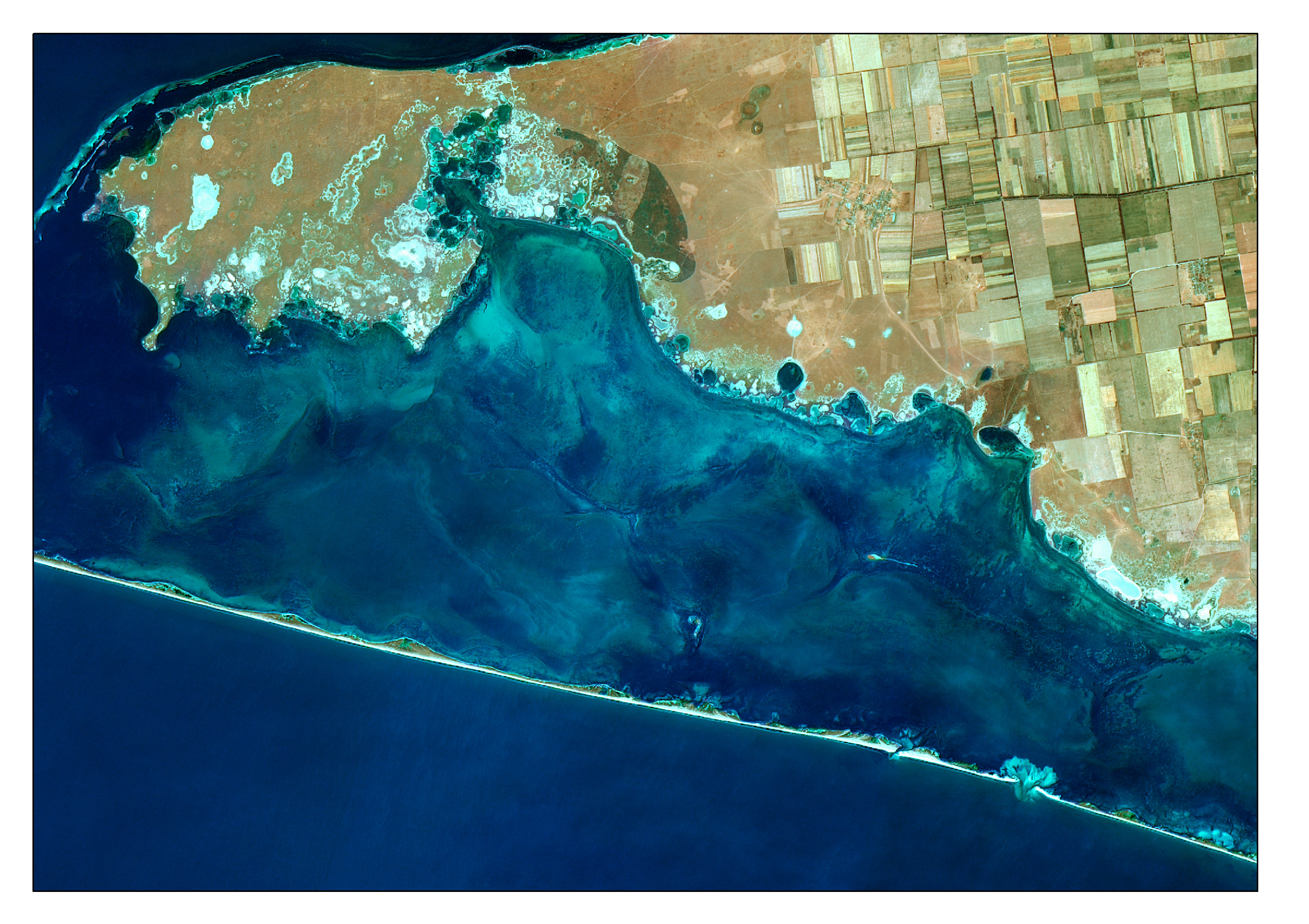
قالب:Uk English: The picture is satellite image of Tendriv Bay. It is captured 8-Aug 2015 by Landsat8 (OLI) under USGS/NASA Landsat Program. The image is created as False Color Composite where:
• R – Short-Wave Infrared 1 (SWIR-1) Band (2.11 - 2.29 µm). At this spectral range water has high absorption of electromagnetic radiation and lands - low. • G – Blue Band (0.45 - 0.51 µm) is useful for bathymetric mapping • B – Coastal-Aerosol Band (0.43 - 0.45 µm) also called violet. Edge visible band allows for imaging and closer investigations of shallow coastal water, and aerosols in the atmosphere. This False Color band combination is suitable for sea shelf, underwater relief structures and water mass movement researches. For emphasizing characteristics, the image was pan-sharpened by panchromatic band. Nonlinear adaptive procedure of contrasting was applied too |
| ⧼wm-license-information-date⧽ | 2015, {{time}} – invalid date format 45 (help) |
| ⧼wm-license-information-source⧽ | ⧼Wm-license-own-work⧽ |
| ⧼wm-license-information-author⧽ | Anastasiya.Tishaeva |
| ⧼wm-license-information-other-versions⧽ |
ترخيص
|
تاريخ الملف
اضغط على زمن/تاريخ لرؤية الملف كما بدا في هذا الزمن.
| زمن/تاريخ | صورة مصغرة | الأبعاد | مستخدم | تعليق | |
|---|---|---|---|---|---|
| حالي | ★ مراجعة معتمدة 07:11، 9 ديسمبر 2023 | | 3٬509 × 2٬478 (6٫12 ميجابايت) | Pastakhov (نقاش | مساهمات) | Upload https://upload.wikimedia.org/wikipedia/commons/e/e5/%D0%A2%D0%B5%D0%BD%D0%B4%D1%80%D1%96%D0%B2%D1%81%D1%8C%D0%BA%D0%B0_%D0%B7%D0%B0%D1%82%D0%BE%D0%BA%D0%B0_Landsat8.jpg |
لا يمكنك استبدال هذا الملف.
وصلات
لا يوجد صفحات تصل لهذه الصورة.