ملف:České Slezsko po roce 1920 na mapě Česka.png
حجم هذه المعاينة: 800 × 460 بكسل. البعدان الآخران: 2٬560 × 1٬471 بكسل | 3٬662 × 2٬104 بكسل.
الملف الأصلي (3٬662 × 2٬104 بكسل حجم الملف: 346 كيلوبايت، نوع MIME: image/png)
وصف قصير
| ⧼wm-license-information-description⧽ |
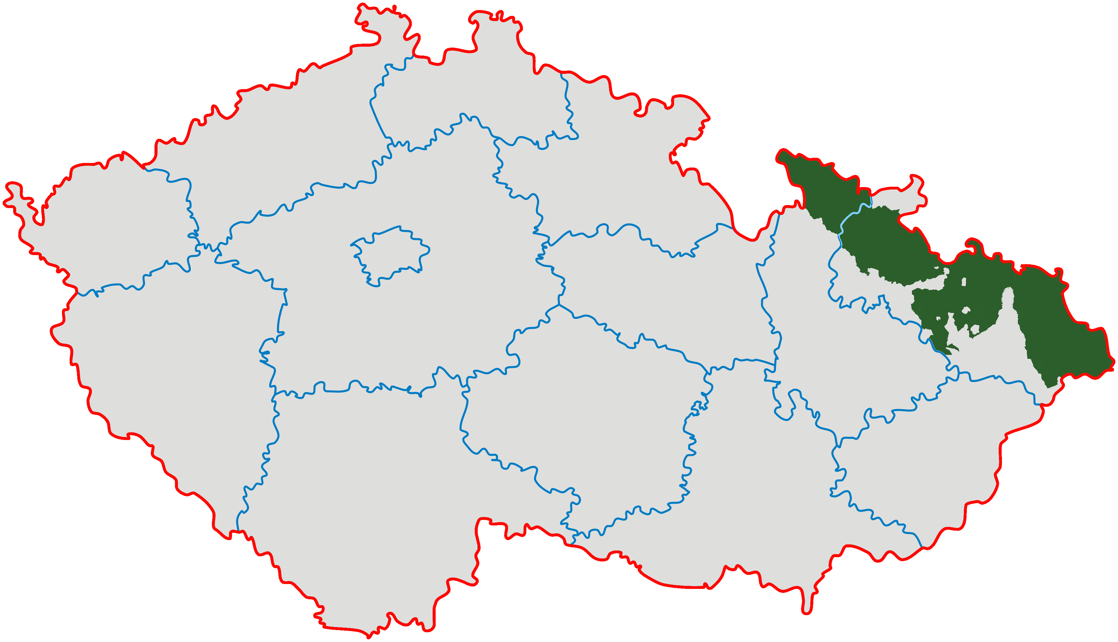
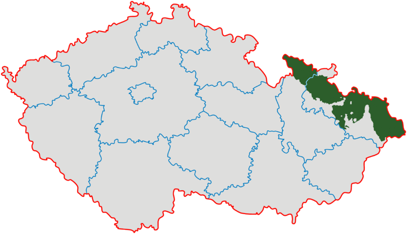
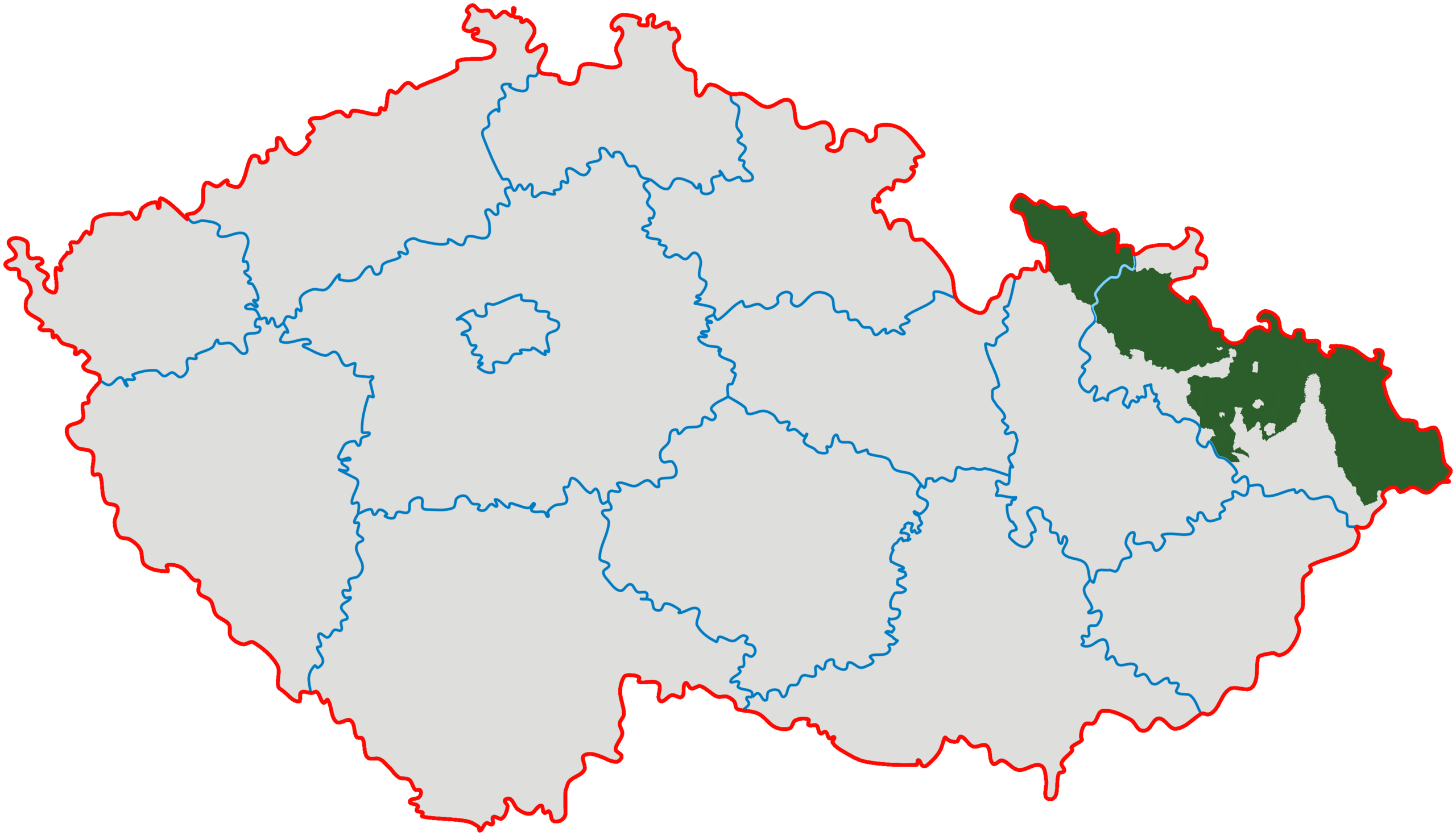
(بالتشيكية) English: Czech Silesia (green); Moravian enclaves in Silesia were governed by Silesian authorities till 1928 (after creation of province of Moravia and Silesia they ceased to exist).
|
| ⧼wm-license-information-date⧽ | |
| ⧼wm-license-information-source⧽ | Modified from Image:Cesko-kraje.svg |
| ⧼wm-license-information-author⧽ | Kirk |
ترخيص
|

تاريخ الملف
اضغط على زمن/تاريخ لرؤية الملف كما بدا في هذا الزمن.
| زمن/تاريخ | صورة مصغرة | الأبعاد | مستخدم | تعليق | |
|---|---|---|---|---|---|
| حالي | ★ مراجعة معتمدة 19:26، 26 أكتوبر 2023 | | 3٬662 × 2٬104 (346 كيلوبايت) | Pastakhov (نقاش | مساهمات) | Upload https://upload.wikimedia.org/wikipedia/commons/d/da/%C4%8Cesk%C3%A9_Slezsko_po_roce_1920_na_map%C4%9B_%C4%8Ceska.png |
لا يمكنك استبدال هذا الملف.
وصلات
لا يوجد صفحات تصل لهذه الصورة.