ملف:Östra Jämjö.svg

حجم معاينة PNG لذلك الملف ذي الامتداد SVG: 611 × 600 بكسل. البعد الآخر: 2٬086 × 2٬048 بكسل.
الملف الأصلي (ملف SVG، أبعاده 4٬490 × 4٬408 بكسل، حجم الملف: 373 كيلوبايت)
| ⧼wm-license-information-description⧽ |
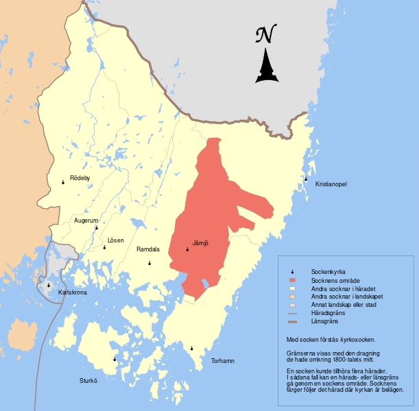
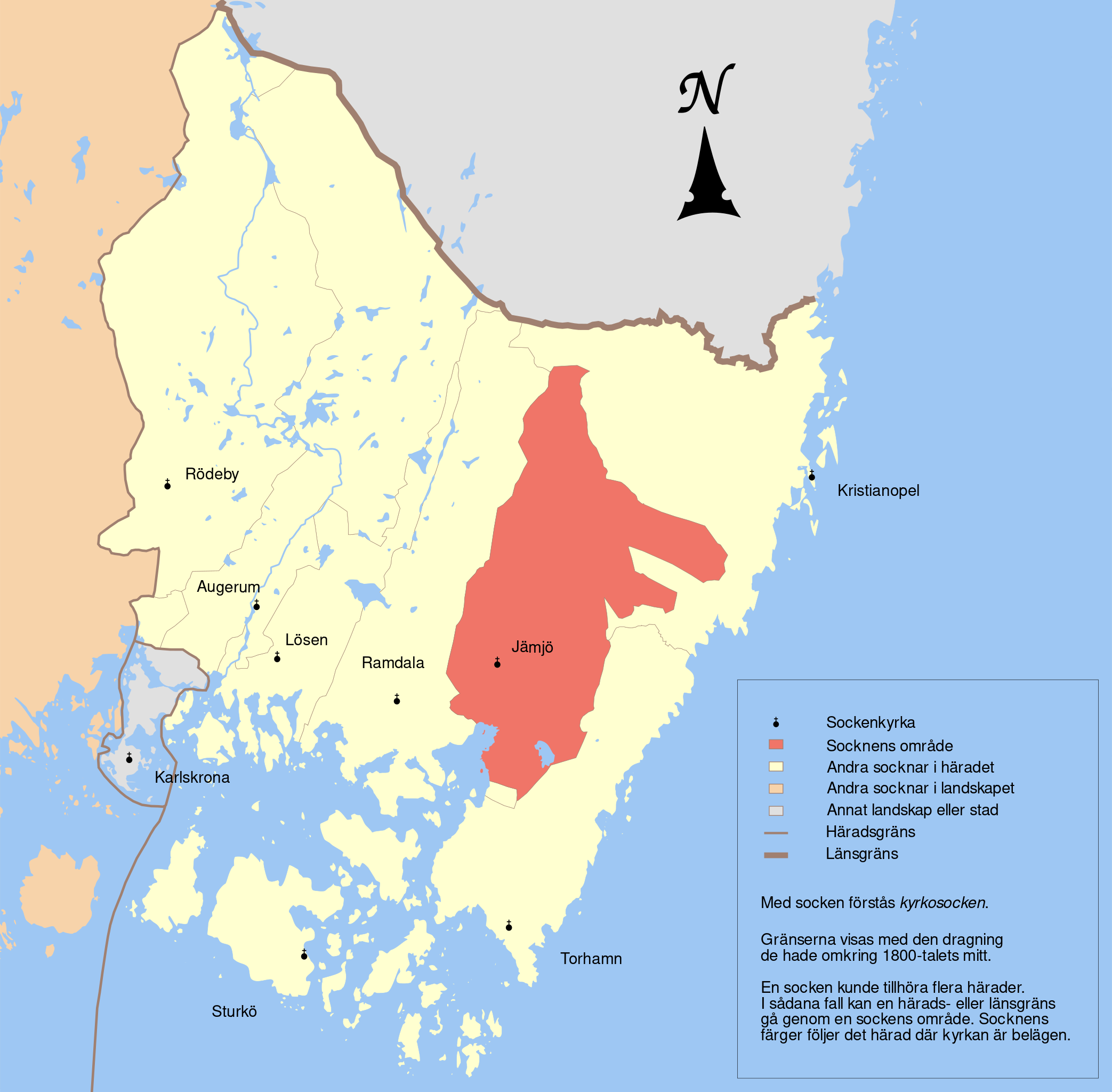
English: Map showing the borders of the civil parish of Jämjö in the hundred of Östra, Blekinge County, Blekinge Region of Sweden. Circa 1850-1900.
|
| ⧼wm-license-information-date⧽ | 2011-05-30 05:16 (UTC) |
| ⧼wm-license-information-source⧽ | |
| ⧼wm-license-information-author⧽ |
|
| [This is a retouched picture, which means that it has been digitally altered from its original version. Modifications: Marked another parish. The original can be viewed here: Östra_Ramdala.svg. Modifications made by Edaen.] Error: {{Lang}}: text has italic markup (help)
|
|
قالب:Original upload log
This image is a derivative work of the following images:
- File:Östra_Ramdala.svg licensed with Cc-by-sa-3.0
- 2011-04-22T10:58:59Z Edaen 4490x4408 (381811 Bytes) {{Information |Description={{en|1=Map showing borders of parishes and hundreds in the vicinity of Karlskrona, based on information from map by Topografiska Corpsen. '''11. Karlskrona''' Topografiska Corpsens karta öfver Sve
تاريخ الملف
اضغط على زمن/تاريخ لرؤية الملف كما بدا في هذا الزمن.
| زمن/تاريخ | صورة مصغرة | الأبعاد | مستخدم | تعليق | |
|---|---|---|---|---|---|
| حالي | ★ مراجعة معتمدة 17:32، 21 أكتوبر 2023 | | 4٬490 × 4٬408 (373 كيلوبايت) | Pastakhov (نقاش | مساهمات) | Upload https://upload.wikimedia.org/wikipedia/commons/e/ed/%C3%96stra_J%C3%A4mj%C3%B6.svg |
لا يمكنك استبدال هذا الملف.
وصلات
لا يوجد صفحات تصل لهذه الصورة.