ملف:Îles éparses.svg

حجم معاينة PNG لذلك الملف ذي الامتداد SVG: 800 × 348 بكسل. البعد الآخر: 2٬560 × 1٬114 بكسل.
الملف الأصلي (ملف SVG، أبعاده 1٬207 × 525 بكسل، حجم الملف: 89 كيلوبايت)
| ⧼wm-license-information-description⧽ |
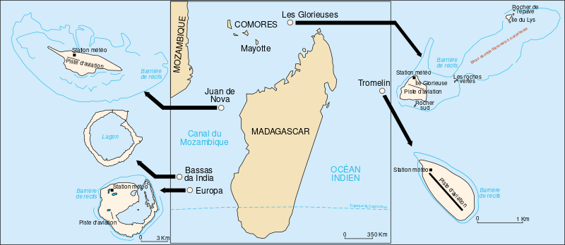
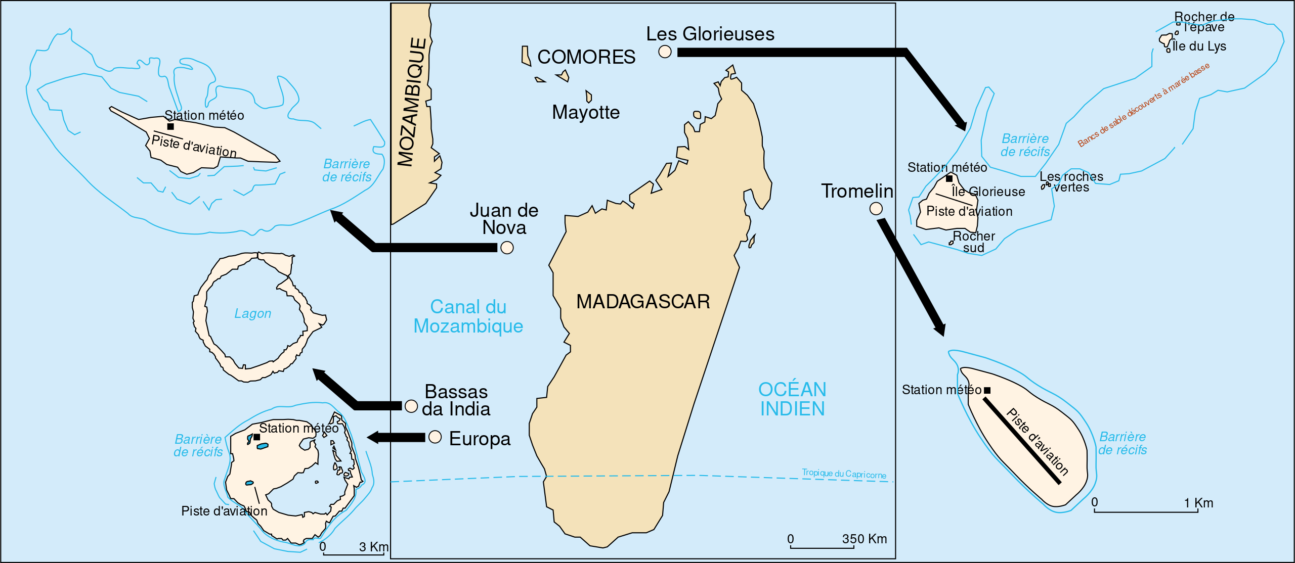
Français : Carte des Îles Éparses dans l'Océan Indien (Terres françaises australes et antarctiques).
English: Scattered Islands in the Indian Ocean (French Southern and Antarctic Lands).
|
|||
| ⧼wm-license-information-date⧽ | 2006 | |||
| ⧼wm-license-information-source⧽ | Image:Iles Eparses-CIA WFB Map.png by User:Hoshie | |||
| ⧼wm-license-information-author⧽ | historicair 21:51, 29 October 2006 (UTC) | |||
| ⧼wm-license-information-permission⧽ (⧼wm-license-information-permission-reusing-text⧽) |
|

تاريخ الملف
اضغط على زمن/تاريخ لرؤية الملف كما بدا في هذا الزمن.
| زمن/تاريخ | صورة مصغرة | الأبعاد | مستخدم | تعليق | |
|---|---|---|---|---|---|
| حالي | ★ مراجعة معتمدة 01:30، 7 نوفمبر 2023 | | 1٬207 × 525 (89 كيلوبايت) | Pastakhov (نقاش | مساهمات) | Upload https://upload.wikimedia.org/wikipedia/commons/8/8c/%C3%8Eles_%C3%A9parses.svg |
لا يمكنك استبدال هذا الملف.
وصلات
لا يوجد صفحات تصل لهذه الصورة.