ملف:"Hukaung Valley".jpg

حجم هذه المعاينة: 800 × 533 بكسل. البعدان الآخران: 2٬560 × 1٬707 بكسل | 3٬994 × 2٬663 بكسل.
الملف الأصلي (3٬994 × 2٬663 بكسل حجم الملف: 8٫48 ميجابايت، نوع MIME: image/jpeg)
وصف قصير
| ⧼wm-license-information-description⧽ |
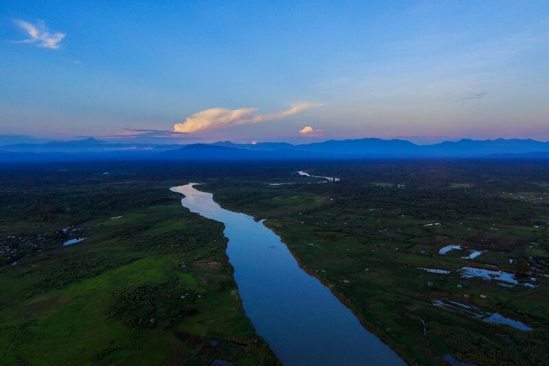
ကချင်ပြည်နယ်ရှိ ဟူးကောင်းချိုင့်ဝှမ်းတစ်နေရာအား ကောင်းကင်ဓာတ်ပုံအဖြစ် ရိုက်ကူးထားခြင်း ဖြစ်ပါသည်။ English: Aerial photo of Hukawng Valley
|
| ⧼wm-license-information-date⧽ | 2018 (according to Exif data) |
| ⧼wm-license-information-source⧽ | ⧼Wm-license-own-work⧽ |
| ⧼wm-license-information-author⧽ | Kyaw_Myo_Hlaing_(Tanai) |
26°22′00″N 96°42′53″E / 26.366667361111112°N 96.71459844444445°E قالب:Mmgeo
ترخيص
|
تاريخ الملف
اضغط على زمن/تاريخ لرؤية الملف كما بدا في هذا الزمن.
| زمن/تاريخ | صورة مصغرة | الأبعاد | مستخدم | تعليق | |
|---|---|---|---|---|---|
| حالي | ★ مراجعة معتمدة 05:40، 20 أكتوبر 2023 | | 3٬994 × 2٬663 (8٫48 ميجابايت) | Pastakhov (نقاش | مساهمات) | Upload https://upload.wikimedia.org/wikipedia/commons/7/7c/%22Hukaung_Valley%22.jpg |
لا يمكنك استبدال هذا الملف.
وصلات
لا يوجد صفحات تصل لهذه الصورة.