ناحية چوروون
ناحية چوروون
철원군 Ch'ŏrwŏn County | |
|---|---|
| الترجمة اللفظية بالـ كورية | |
| • چوسونگول | 철원군 |
| • هانچا | 鐵原郡 |
| • مكيون-رايشاور | Ch'ŏrwŏn-gun |
| • رومنة الكورية المعدلة | Cheorwon-gun |
 | |
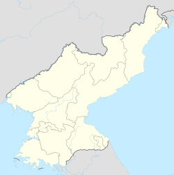
| الإحداثيات: 38°20′35″N 126°54′21″E / 38.3431°N 126.9058°E | |
| البلد | كوريا الشمالية |
| المقاطعة | مقاطعة كانگوون |
| التقسيمات الادارية | 1 ŭp, 36 ri |
| المساحة | |
| • الإجمالي | 457 كم² (176 ميل²) |
| التعداد (1991 est.) | |
| • الإجمالي | 100٬000 |
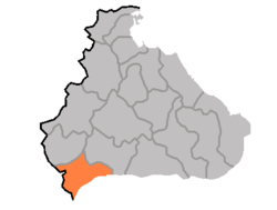
Ch'ŏrwŏn County هي كون، أو ناحية، في مقاطعة كانگوون، كوريا الشمالية. Portions of it were once a single county together with the county of the same name في كوريا الجنوبية؛ other portions were added from neighbouring counties في إعادة تنظيم الحكم المحلي 1952.[1] بعد تقسيم كوريا المبدئي، وقعت الناحية كلها شمال خط التقسيم، ولكن أثناء الحرب الكورية فإن جزءاً من الناحية أخذه الجنوب.
. . . . . . . . . . . . . . . . . . . . . . . . . . . . . . . . . . . . . . . . . . . . . . . . . . . . . . . . . . . . . . . . . . . . . . . . . . . . . . . . . . . . . . . . . . . . . . . . . . . . . . . . . . . . . . . . . . . . . . . . . . . . . . . . . . . . . . . . . . . . . . . . . . . . . . . . . . . . . . . . . . . . . . . .
الجغرافيا
The county's terrain is mountainous in the north, but gradually more level towards the south. The Masingryong Mountains pass through the county; the highest point of which is the 1,360-metre (4,460 ft) Taehwang Peak (대왕덕산). The chief watercourse is the Rimjin River. Approximately 54% of the county's area is occupied by forests.
التقسيمات الادارية
تنقسم مقاطعة چوون إلى 1 أوپ (بلدة) و 36 ري (قرية):
|
|
|
الاقتصاد
The chief local industry is agriculture. The county is a major producer of rice for North Korea. Additional crops include maize, soybeans, wheat, and barley. Other local industries include mining, sericulture, and orcharding. The county is host to deposits of coal, iron ore, magnetite, and manganese. There is little manufacturing.
النقل
The county is not connected to the national rail grid, but is served by roads.
انظر أيضاً
- جغرافيا كوريا الشمالية
- التقسيمات الادارية لكوريا الشمالية
- مقاطعة كانگوون (كوريا الشمالية)
- Anhyop County
