جزيرة إلـِسمير
Native name: Umingmak Nuna | |
|---|---|
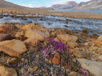
 تندرا في منتزه قوتـّينيرپآق الوطني]] | |
 | |
| الجغرافيا | |
| الموقع | شمال كندا |
| الإحداثيات | 79°50′N 78°00′W / 79.833°N 78.000°W |
| الأرخبيل | جزر الملكة إليزابث |
| المساحة | 196،235 km2 (75،767 sq mi) |
| ترتيب المساحة | 10th |
| الطول | 830 km (516 mi) |
| العرض | 645 km (400٫8 mi) |
| أعلى منسوب | 2٬616 m (8٬583 ft) |
| أعلى نقطة | قمة باربو |
| الإدارة | |
Canada | |
| المقاطعة | نوناڤوت |
| Largest settlement | گريس فيورد (pop. 129) |
| السكان | |
| التعداد | 191 (2016) |
| الكثافة السكانية | 0٫00097 /km2 (0٫00251 /sq mi) |
| معلومات إضافية | |
| Area code(s) | 867 |
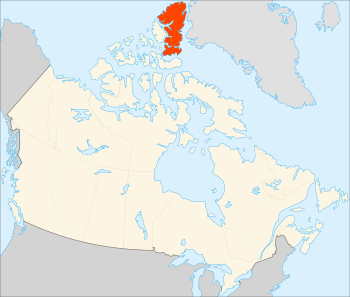
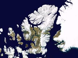
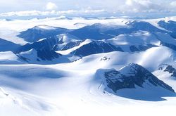
جزيرة إلـِسمير Ellesmere Island، (اومينگماك نونا، وتعني "أرض ثور المسك)[1] هي جزء من اقليم قيكيقتالوك، في مقاطعة نوناڤوت الكندية. تقع الجزيرة في الأرخبيل القطبي الكندي، وكانت تعتبر جزء من جزر الملك إليزابث، وتشكل هي ورأس كلومبيا أقصى النقاط شمالاً في كندا. تمتد الجزيرة على مساحة 196,235 كم² واجمالي طول الجزيرة 830 كم، لتصبح عاشر أكبر جزيرة في العالم وثالث أكبر جزيرة في كندا. يغطي نظام جبال الكورديلرا القطبية معظم جزيرة إلـِسمير، مما يجعلها أكثر المناطق الجبلية في الأرخبيل القطبي الكندي. الصفصاف القطبي هو الفصيلة الخاشبة الوحيدة التي تنمو في جزيرة إلـِسمير.[2]
التاريخ
كان أول البشر الذين استوطنوا الجزيرة عبارة عن مجموعات صغيرة أتت لصيد رنة پيري، ثور المسك والثدييات البحرية عام 2000-1000 ق.م.[3]
الجغرافيا
المناطق المحمية
المثالج والقمم الجليدية
علم المتحجرات
علم بيئة الحشرات
السكان
عام 2006 وصل عدد سكان جزيرة إلـِسمير إلى 146 نسمة. ويوجد بها ثلاثة مستوطنات، ألرت (5 نسمة)،[4] يوريكا (لا يوجد سكان مقيمون، لكن يوجد عدد من السكان الرحل)، وگريسه فيورد (141 نسمة).[5] سياسياً، الجزيرة جزء من اقليم قيكيقتالوك.
انظر أيضاً
المصادر
- ^ Lyle Dick. Muskox Land: Ellesmere Island in the age of contact. University of Calgary Press, 2001.
- ^ Ed Kemmick (October 25, 2007). "Researcher: Study of poles needed". Billingsgazette.net. Retrieved October 25, 2007.[dead link]
- ^ Civilization.ca. "Arctic History". Archived from the original on September 23, 2008.
- ^ Statistics Canada
- ^ 2006 census
قراءات إضافية
- Dick, Lyle. Muskox Land Ellesmere Island in the Age of Contact. Calgary: University of Calgary Press, 2001. ISBN 1-55238-050-5
- Eberle, Jaelyn, and Malcolm McKenna. 2002. "Early Eocene Leptictida, Pantolesta, Creodonta, Carnivora, and Mesonychidae (Mammalia) from the Eureka Sound Group, Ellesmere Island, Nunavut". Canadian Journal of Earth Sciences. 39: 899–910.
- Kobalenko, Jerry. The Horizontal Everest Extreme Journeys on Ellesmere Island. New York, NY: Soho, 2002. ISBN 1-56947-266-1
- Manseau, Micheline, Lyle Dick, and Natasha Lyons. People, caribou, and muskoxen on northern Ellesmere Island historical interactions and population ecology, ca. 4300 BP to present = Humains, caribous et boeuf musqués dans le nord de l'Île d'Ellesmere : interactions historiques et écologie des populations, v. 4 300 AA jusqu'à aujourd'hui = Inuit, tuttuit, ammalu umimmait aisuittup qikiqsuluata uannaqpasinggani : uatsiarisnisait qanuiliusninggit ammalu amiruninnginnit nasainiq uumajurnit, ca 4300 BP maannamut. [Ottawa]: Parks Canada = Parcs Canada, 2005. ISBN 0-662-68835-X
- Schledermann, Peter, and Karen Margrethe McCullough. Late Thule Culture Developments on the Central East Coast of Ellesmere Island. Copenhagen: (Dansk) Danish Polar Center, 2003. ISBN 87-90369-64-5


