نهر التمز
| River Thames | |
| River | |
| البلد | England |
|---|---|
| Counties | Gloucestershire, Wiltshire, Oxfordshire, Berkshire, Buckinghamshire, Surrey, London, Kent, Essex |
| Towns/cities | Cricklade, Lechlade, Oxford, Abingdon, Wallingford, Reading, Henley-on-Thames, Marlow, Maidenhead, Windsor, Staines-upon-Thames, Walton-on-Thames, Kingston upon Thames, Teddington, Westminster, London |
| Source | |
| - الموقع | Thames Head, Gloucestershire, UK |
| - elevation | 110 m (361 ft) |
| المصب | Thames Estuary, North Sea |
| - الموقع | Southend-on-Sea, Essex, UK |
| - الارتفاع | 0 m (0 ft) |
| الطول | 346 km (215 mi) |
| الحوض | 12,935 km2 (4,994 sq mi) |
| التدفق | for London |
| - المتوسط | 65.8 m3/s (2,324 cu ft/s) |
| - الأقصى | 370 m3/s (13,066 cu ft/s) |
| Discharge elsewhere (average) | |
| - entering Oxford | 17.6 m3/s (622 cu ft/s) |
| - leaving Oxford | 24.8 m3/s (876 cu ft/s) |
| - Reading | 39.7 m3/s (1,402 cu ft/s) |
| - Windsor | 59.3 m3/s (2,094 cu ft/s) |
Map of the Thames within southern England
| |
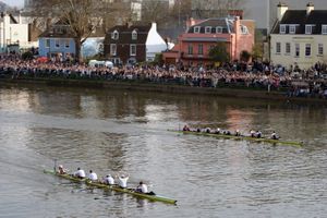
'نهر التـِمز (إنگليزية: Thames؛ /tɛmz/ TEMZ)، هو نهر يقع في جنوب إنگلترة في المملكة المتحدة يبلغ طوله 346 كم. ينبع نهر التايمز من منطقة كيمبل في انكلترا و يمر بمدن بريطانية عديدة مثل أوكسفورد و ردنگ و سلاو و لندن قبل ان يصب في بحر الشمال إلى جهة الشرق من مدينة لندن. و يمنح النهر إسمه إلى منطقة جغرافية تقع بين أكسفورد إلى الغرب و حتى مصبه إلى الشرق من مدينة لندن و التي تعرف بوادي نهر التيمز. يستخدم نهر التيمز كوسيلة نقل مائية و خصوصا في لندن حيث تقو سفن و قوراب بجولات سياحية لتمر بوسط المدينة من خلاله كما توجد فيه شرطة نهرية متخصصة. إضافة إلى هذا فالنهر يستخدم في العديد من النشاطات الرياضية و الترفيهية سنوياً مثل سباقات القوارب و التجديف.
مسار النهر
.
القسم الخالي من الأمواج
القسم المتماوج
الجزر
التاريخ الجيولوجي
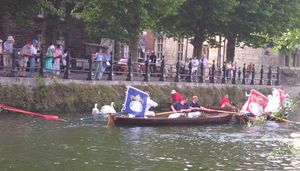
[[Image:PentonHIsle.JPG|thumb|يسار|Fishing at Penton Hook Island
Human history
أصل الإسم
The active river
The tidal river
The upper river
الشرطة وقوارب النجاة
الملاحة
History of the management of the river
The river as a boundary
المعابر
[[Image:Hammerton's Ferry casting off.jpg|يسار|thumb|Hammerton's Ferry near ]]
الرياضة
التجديف
الإبحار
Skiffing
التسيير
تجديف زوارق الكياك والكنو
التعرجات
ثقافة
فنون بصرية
في الأدب
في السينما والتلفزيون
أنظر أيضاً
- 1947 Thames flood
- Thames sailing barge
- River and Rowing Museum
- Rivers of the United Kingdom
- List of locations in the Port of London
- Thames Town
- Thames Television
- London Stones beside the river
- Nore
- Subterranean rivers of London
المصادر
قراءات أخرى
- Ackroyd, Peter (2007). Thames: Sacred River. Chatto and Windus. ISBN 0701172843.
وصلات خارجية
| Thames
]].- The River Thames Guide - Covers all of the Thames and many aspects including Accommodation, Thames Information, etc.
- A guide to the River Thames Above Teddington - Information on boating, fishing, walking and places to eat, drink and stay.
- The Thames Estuary Partnership
- River Thames
- Article includes map of the River Thames catchment area
- Thames Gallery at the River and Rowing Museum, Henley-on-Thames
- The Thames Path
- The Thames Path National Trail
- The Thames from Hampton Court to Sunbury Lock
- Fantasy flight along the Thames in a high-speed pod from the London Eye!
- Photos of the Thames at central London
- Independent Guide to the River Thames and its famous Tow Path
- Walks along the Thames Path
- Source of the Thames from Google Maps — this map stops tracing the river at Ashton Keynes, south-west from Kemble (51°38′15″N 1°56′23″W / 51.637411°N 1.939774°W)
- Michael Pead :: Photos of the River Thames
- Where Thames Smooth Waters Glide - by John Eade
- Physiography, T.H. Huxley, 1978 The physical geography of the Thames River Basin as seen by Huxley in 1878. Full text free to read and search, Courtesy the Carnegie Museum of Natural History Library.
- The Mirror of the Sea, Joseph Conrad at Wikiquote. From the estuary to the Port of London by boat in 1906, when the port was the commercial heart of the British Empire.
- London's River - An intriguing journey down the Thames in rare archive film.
- William Morris and the River Thames
- River Thames - A Brief History Article explaining the Thames' History over 400,000 years.
- River Thames Boat Blog - A blog with articles dedicated to helping people get the most from boating on the Tidal River Thames in London.
- Pages using geobox2 unit with unknown unit type
- Geobox usage tracking for river type
- Articles containing إنگليزية-language text
- Pages using Lang-xx templates
- Pages using gadget WikiMiniAtlas
- Rivers of Berkshire
- Rivers of Buckinghamshire
- Rivers of Essex
- Rivers of Gloucestershire
- Rivers of Kent
- Rivers of London
- Rivers of Oxfordshire
- Rivers of Surrey
- River navigations in England
- Visitor attractions in London
- River Thames
- Rivers of England
- Thames basin
- أنهار المملكة المتحدة
- لندن


