ملف:Southern Levant map.svg

الملف الأصلي(ملف SVG، أبعاده 524 × 524 بكسل، حجم الملف: 418 كيلوبايت)

وصف قصير

⧼wm-license-information-description⧽
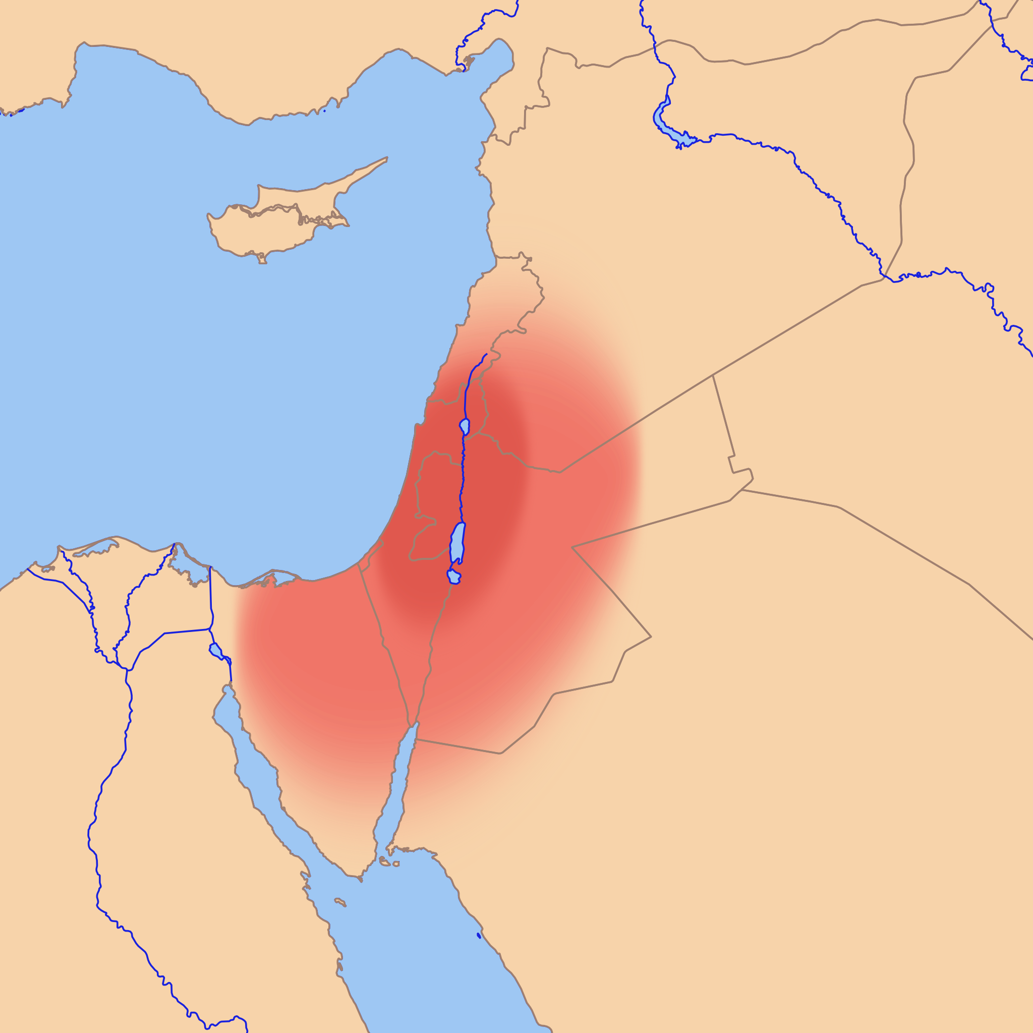
English: Location map of the en:Southern Levant, based on an approximate, geographic definition:
  • "The southern Levant, as defined here, is delimited by the Litani River to the north, the Jordan Rift Valley to the East, the Gulf of Aqaba to the south, and the Mediterranean Sea and Sinai Desert to the west."[1]
  • "The region defined as the Southern Levant encompasses the territory crossed by the valleys of the Litani and Jordan, including the Mediterranean littoral extending from Lebanon to northern Sinai. Moreover, the Negev, the Sinai peninsula and Jordan are considered parts of this vast region."[2]
  • "The southern Levant refers to all of the territory south of the headwaters of the Orontes River and west of the Syrian Desert"[3]

Legend

قالب:Legend-small قالب:Legend-small

References

  1. ^ Peregrine, Peter N.; Ember, Melvin (2003). Encyclopedia of Prehistory: Volume 8: South and Southwest Asia. Springer Science & Business Media. p. 86. ISBN 9780306462627.
  2. ^ Yakar, Jak (1998). "The socio-economic structure of prehistoric communities in the Southern Levant, ca. 13000-8000 BP". Documenta Praehistorica. XXV.
  3. ^ Routledge, Bruce (2004). Moab in the Iron Age: Hegemony, Polity, Archaeology. University of Pennsylvania Press. p. 223. ISBN 081223801X.
⧼wm-license-information-date⧽ 2016
⧼wm-license-information-source⧽ ⧼Wm-license-own-work⧽
⧼wm-license-information-author⧽ Joe Roe

ترخيص


I, the copyright holder of this work, hereby publish it under the following license:

تاريخ الملف

اضغط على زمن/تاريخ لرؤية الملف كما بدا في هذا الزمن.

زمن/تاريخصورة مصغرةالأبعادمستخدمتعليق
حالي ★ مراجعة معتمدة
08:14، 14 ديسمبر 2023
تصغير للنسخة بتاريخ 08:14، 14 ديسمبر 2023524 × 524 (418 كيلوبايت)Pastakhov (نقاش | مساهمات)Upload https://upload.wikimedia.org/wikipedia/commons/f/f6/Southern_Levant_map.svg

لا يوجد صفحات تصل لهذه الصورة.

معلومات الصورة (ميتا)