ملف:Mapa sp.svg

حجم معاينة PNG لذلك الملف ذي الامتداد SVG: 400 × 600 بكسل. البعد الآخر: 1٬365 × 2٬048 بكسل.
الملف الأصلي (ملف SVG، أبعاده 1٬200 × 1٬800 بكسل، حجم الملف: 351 كيلوبايت)
وصف قصير
| ⧼wm-license-information-description⧽ |
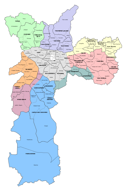
Map of the city of São Paulo, with the delimitations of districts, subprefectures and zones. |
| ⧼wm-license-information-date⧽ | قالب:Original upload date |
| ⧼wm-license-information-source⧽ | No machine-readable source provided. Own work assumed (based on copyright claims). |
| ⧼wm-license-information-author⧽ | No machine-readable author provided. Fsolda~commonswiki assumed (based on copyright claims). |
ترخيص
تاريخ الملف
اضغط على زمن/تاريخ لرؤية الملف كما بدا في هذا الزمن.
| زمن/تاريخ | صورة مصغرة | الأبعاد | مستخدم | تعليق | |
|---|---|---|---|---|---|
| حالي | ★ مراجعة معتمدة 11:24، 29 أكتوبر 2023 | | 1٬200 × 1٬800 (351 كيلوبايت) | Pastakhov (نقاش | مساهمات) | Upload https://upload.wikimedia.org/wikipedia/commons/5/56/Mapa_sp.svg |
لا يمكنك استبدال هذا الملف.
وصلات
لا يوجد صفحات تصل لهذه الصورة.