ملف:Hong Kong Railway Route Map zh-hant.svg

حجم معاينة PNG لذلك الملف ذي الامتداد SVG: 655 × 599 بكسل. البعد الآخر: 2٬238 × 2٬048 بكسل.
الملف الأصلي (ملف SVG، أبعاده 1٬557 × 1٬425 بكسل، حجم الملف: 51 كيلوبايت)
وصف قصير
قالب:Igen
| ⧼wm-license-information-description⧽ |
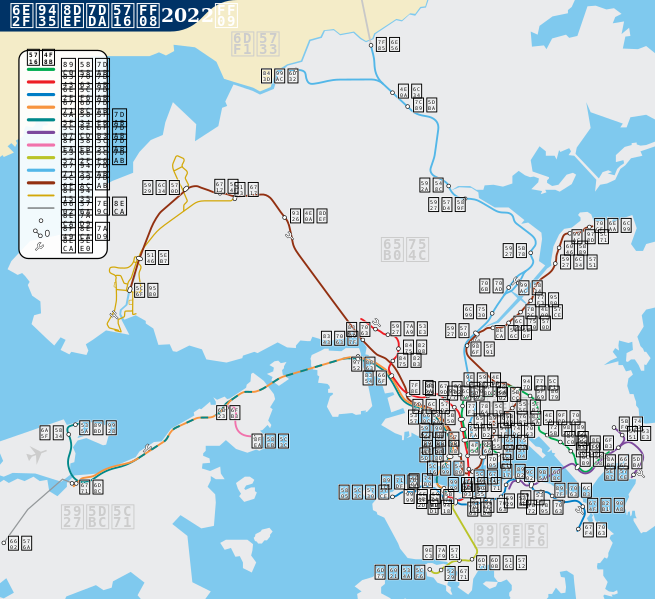
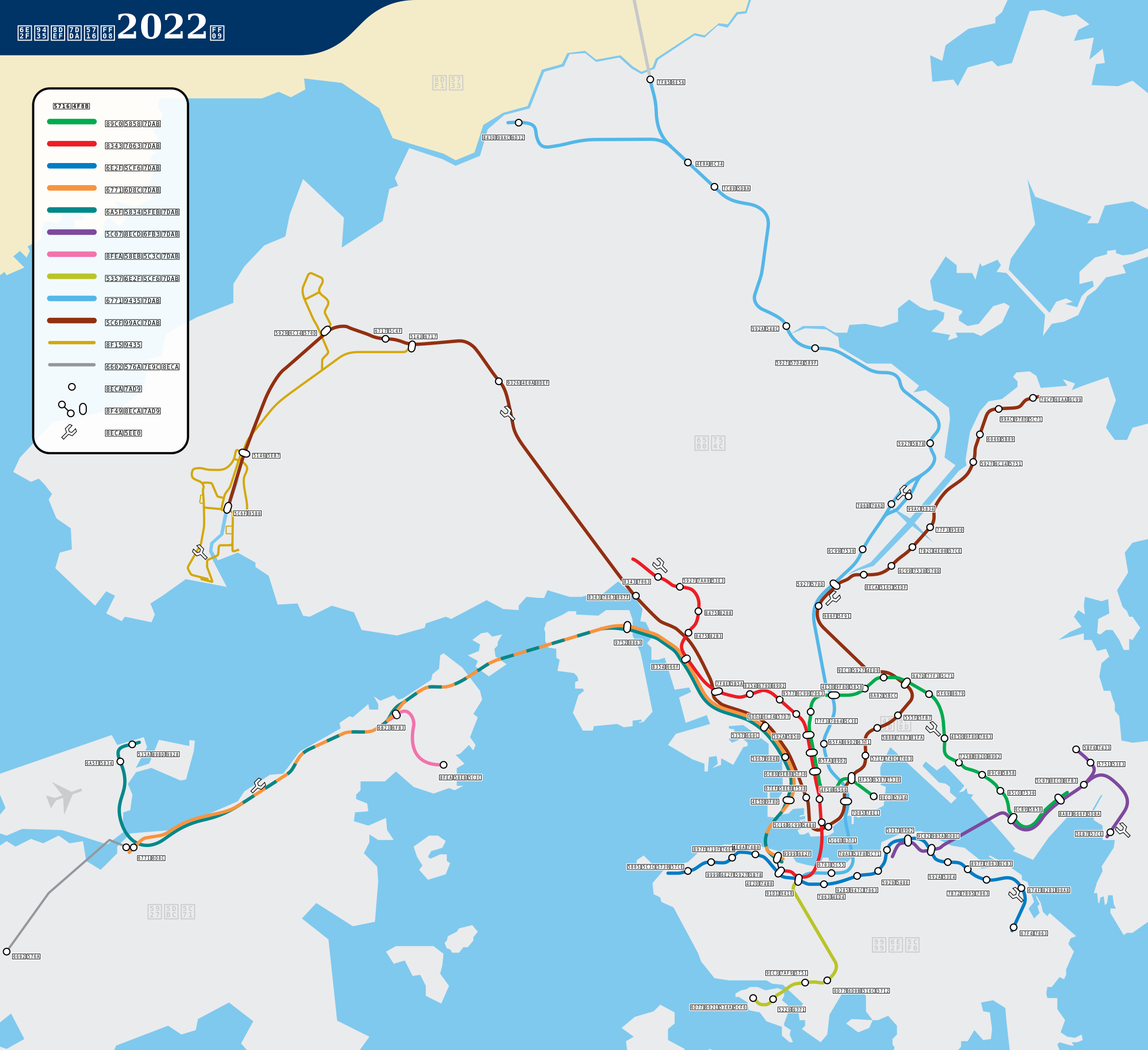
English: SVG route map for the MTR (Traditional Chinese), the Hong Kong metro/subway system. It does not mean to be wholly accurate but offers a roughly geographical sense of Hong Kong territories and the MTR system.
Deutsch: SVG Liniennetzplan für der خطأ لوا في وحدة:Wd على السطر 2576: The function "Mass Transit Railway" does not exist. (Chinesisch), die U-Bahn System von Hongkong
|
||
| ⧼wm-license-information-date⧽ | 2007 | ||
| ⧼wm-license-information-source⧽ | ⧼Wm-license-own-work⧽ | ||
| ⧼wm-license-information-author⧽ | Sameboat | ||
| ⧼wm-license-information-permission⧽ (⧼wm-license-information-permission-reusing-text⧽) |
|
||
| ⧼wm-license-information-other-versions⧽ |
|


تاريخ الملف
اضغط على زمن/تاريخ لرؤية الملف كما بدا في هذا الزمن.
| زمن/تاريخ | صورة مصغرة | الأبعاد | مستخدم | تعليق | |
|---|---|---|---|---|---|
| حالي | ★ مراجعة معتمدة 09:06، 14 أكتوبر 2023 | | 1٬557 × 1٬425 (51 كيلوبايت) | Pastakhov (نقاش | مساهمات) | Upload https://upload.wikimedia.org/wikipedia/commons/1/1d/Hong_Kong_Railway_Route_Map_zh-hant.svg |
لا يمكنك استبدال هذا الملف.
وصلات
لا يوجد صفحات تصل لهذه الصورة.